


From rugged mountains to icy lakes and powerful waterfalls, Colorado is home to some of the world’s most remarkable landscapes. It’s hard to pinpoint the most beautiful spots in this state as beauty is subjective after all, but this round-up of Colorado hikes does the job pretty dang well. Whether you’re getting out there this summer or just perusing and dreaming up future journeys, enjoy our collection of the 10 most beautiful hikes in Colorado.
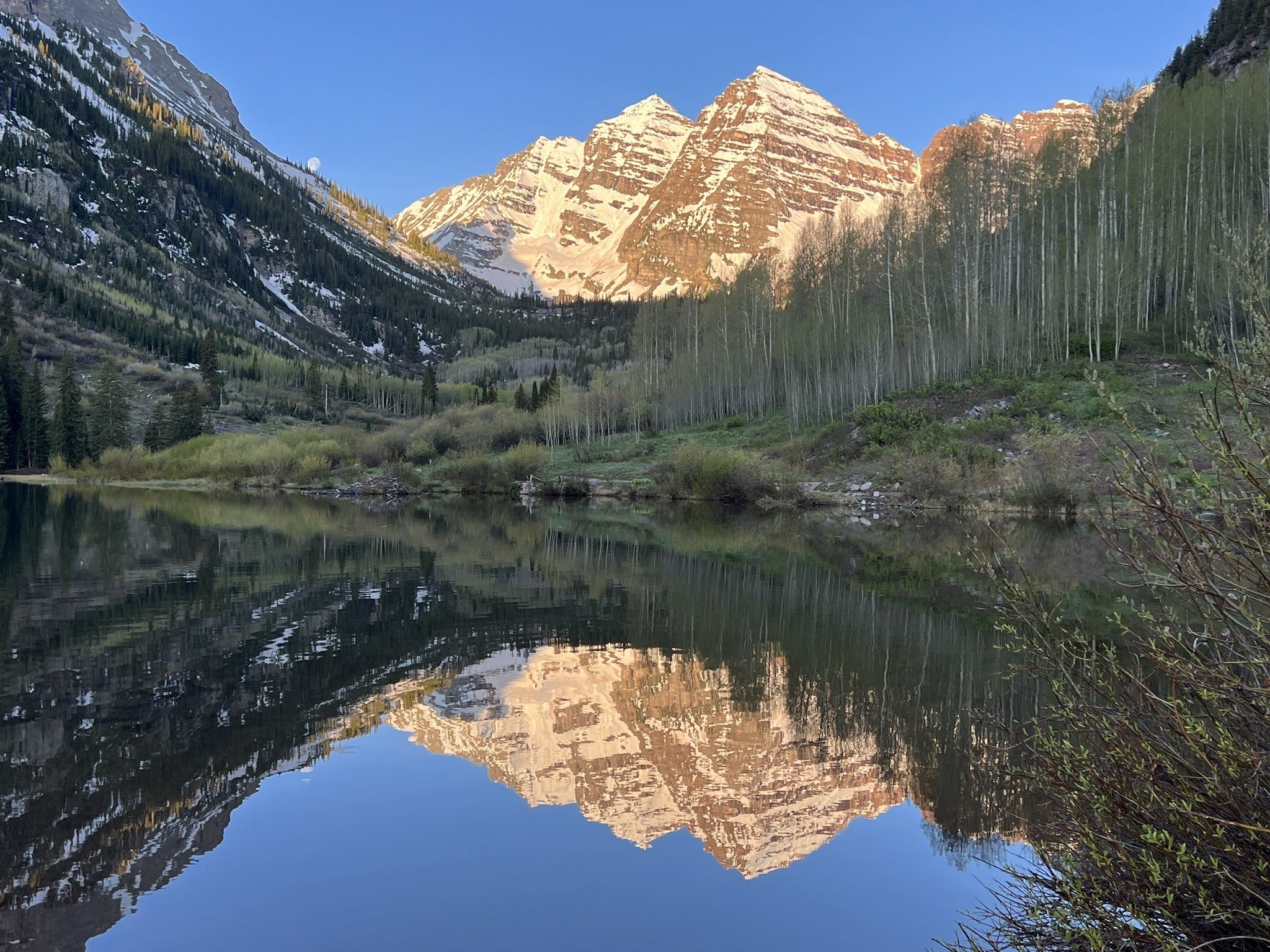
Maroon Bells Scenic Route Trail
Distance: 1.9 miles
Route Type: Loop
Drive From Denver: 3 hours 40 minutes
Location: Aspen School District 1, Colorado
A true Colorado wonder, the Maroon Bells hold the type of crisp beauty that will leave you in awe. The Scenic Route is a fairly quick and easy trail that gives you a striking view of Maroon Lake and a great general feel of the Snowmass Wilderness. The trail takes you along the Northern side of the lake, past a little waterfall, and up and around West Maroon Creek. There are pull-offs along the trail where you can relax and take it all in. This short scenic route is the best bet for getting an up-close look at the famed lake, but if you’re looking for longer hikes in the area, a few favorites include Crater Lake, Thomas Lakes Trail and Four Pass Loop.
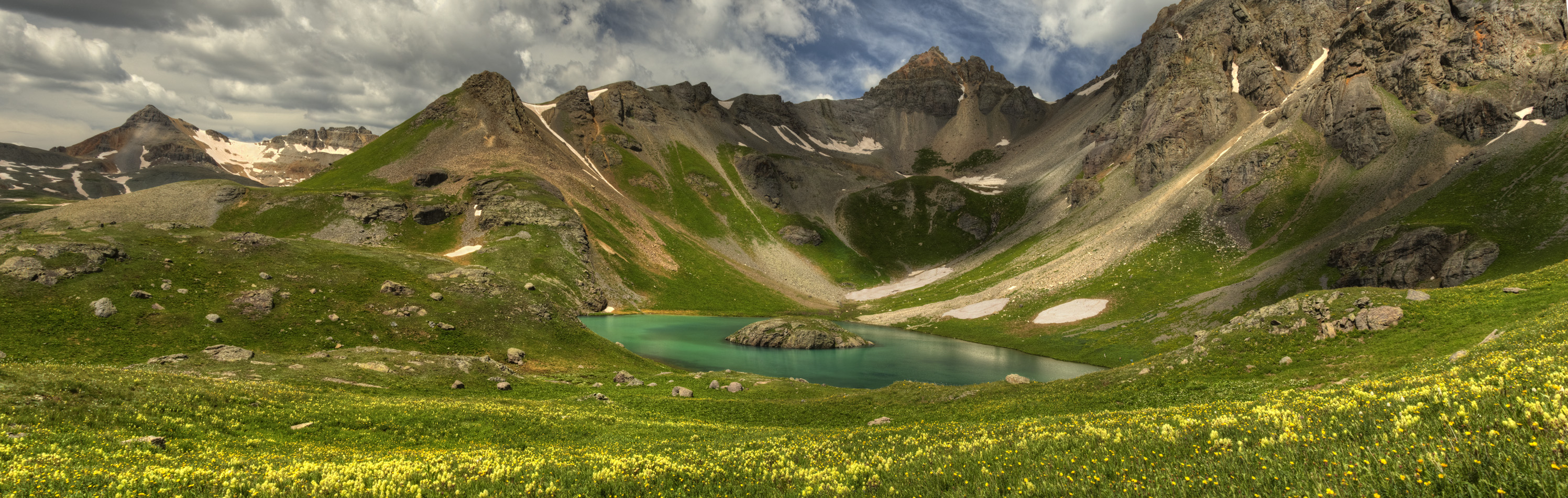
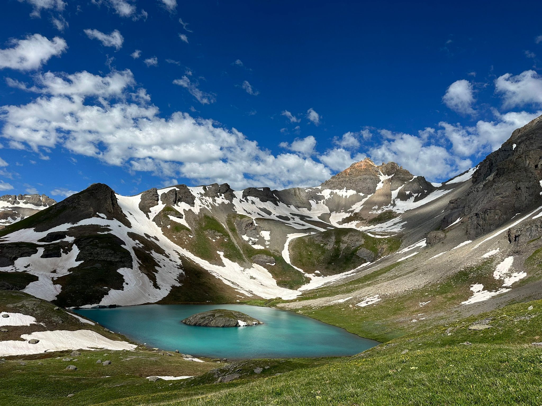
Ice Lakes Trail
Distance: 6.9 miles
Route Type: Loop
Drive From Denver: 6 ½ hours
Location: Ice Lake Trailhead, 37. -773, 806 Washington 107, Durango, CO 81301
Experience the wondrous aqua-blue alpine lakes of the Ice Lakes Trail. Nestled in the San Juan Mountains, near the town of Silverton, this trail takes you on an elevated journey through the tundra to Island Lake and Ice Lake. This is a fairly challenging trek mainly due to the steep terrain and high altitude gains, so come prepared for a workout. Island Lake sits at 12,400 feet and Ice Lake is at a shocking 13,767 feet. Pack up and prepare to spend a good portion of the day summiting the lakes as the hike takes on average five hours, plus allow time to enjoy lunch at the lake or even enjoy a cool dip in the water.
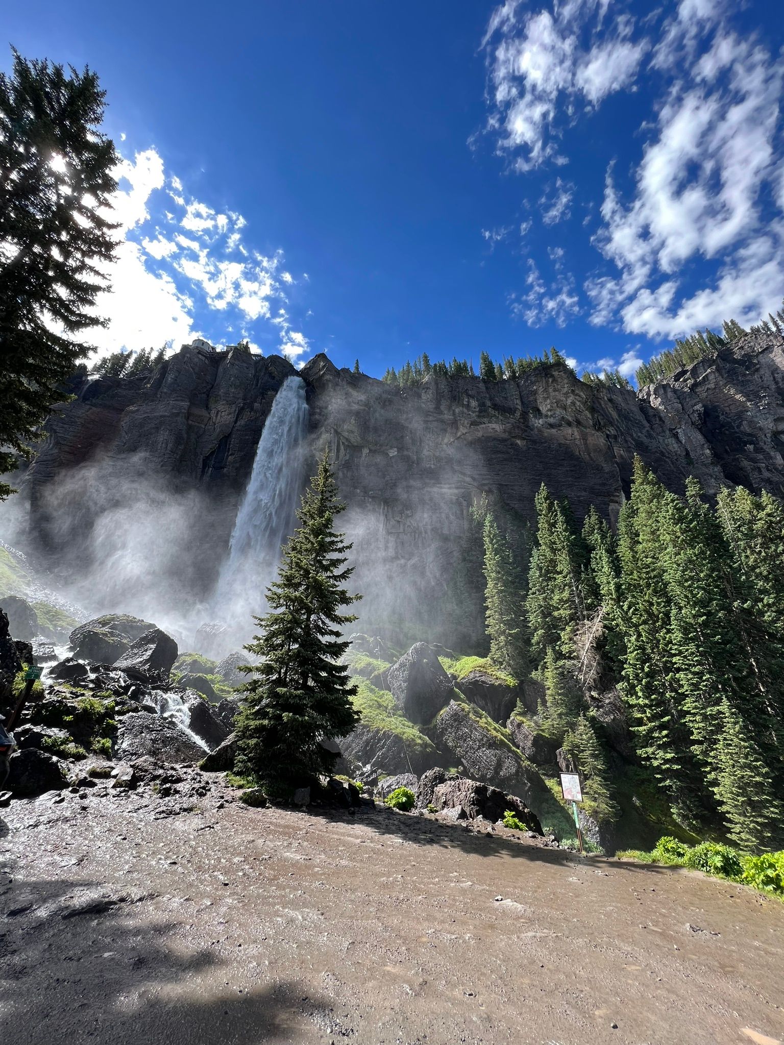
Bridal Veil Falls Trail
Distance: 2 miles
Route Type: Out and Back
Drive From Denver: 6 ½ hour
Location: Bridal Veil Trail, Forest Service Rd 648, Telluride
Centered at the base of the box canyon, Bridal Veil Falls in Telluride is Coloarado’s largest waterfall at 365 feet and is the town’s most iconic feature. Feel the cool mist on your skin and get up close to this powerful Colorado waterfall with this approachable two-mile trail that will lead you right to the base of the falls. Along the way, enjoy a plethora of smaller waterfalls as Ingram Creek and Bridal Veil Creek flow down the mountain. The trail can get a bit wet, so be cautious of slipping. Other than that, enjoy the journey and take in the lush landscape this area has to offer.
Chasm Lake
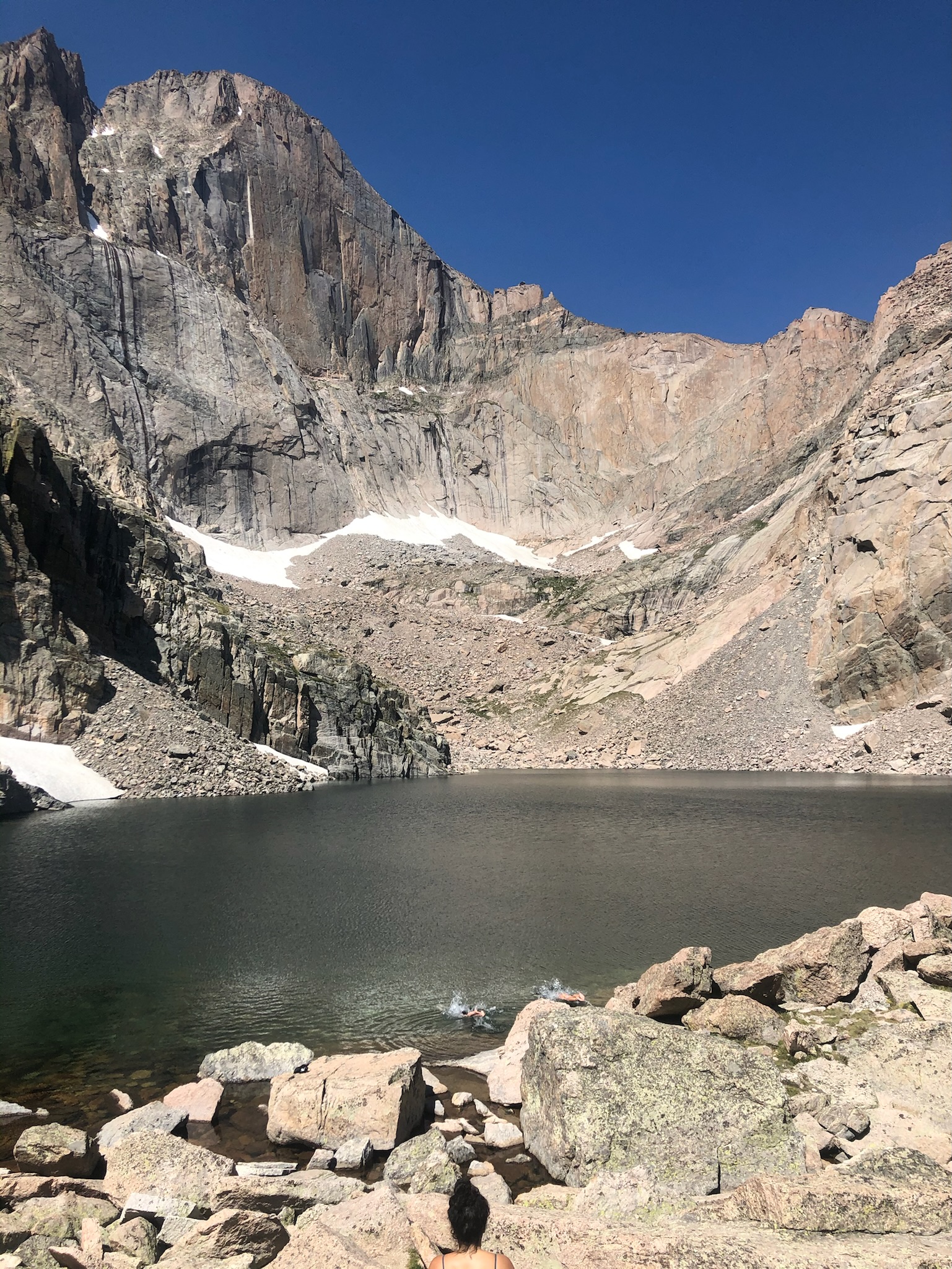
Distance: 8 miles
Route Type: Out and Back
Drive From Denver: 1 hour ½
Location: Longs Peak Ranger Station, Estes Park
Resting at 11, 760 feet with towering granite walls and a pristine alpine lake, Chasm Lake in Rocky Mountain National Park is a true natural beauty. The 8-mile trek is definitely long and a bit technical, but the destination makes everything worth it. There’s a small boulder scramble at the top just as you’re getting to the lake, so prepare to be adventurous with that footwork. On your journey, you’ll see waterfalls, an array of wildflowers and high alpine rock formations that just might rock your world.
Shrine Ridge Trail
Distance: 4.3 miles
Route Type: Out and Back
Drive From Denver: 1 ½ hour
Location: Shrine Pass Road Parking, Summit County
If you’re looking to enjoy the vastness of the Rocky Mountains not too far from Denver, Shrine Ridge Pass is the place to go. The pass is located just off I-70 between Copper and Vail. Best known for its copious amounts of wildflowers in July and into August, Shrine Ridge is a favorite for those looking for wildflowers hikes near Denver. Hike all the way out to the end of the ridge to reach the top of Shrine Mountain at 11, 745 feet, for some spectacular mountain views.
Blue Lakes Trail – lower, middle & upper
Distance: 8.7 miles
Route Type: Out and Back
Drive From Denver: Around 6 hours
Location: Blue Lakes Trailhead, Blue Lakes Trail, Telluride, CO 81435
The Blue Lakes triad is another magical glacial basin in southwestern Colorado. The name gives it away, as the lakes are in fact, very blue — the type of icy blue that can’t possibly be real. In order to access all three lakes, enjoy a challenging 8.7-mile hike that takes you through alpine forests, fields of wildflowers (in July and August), waterfalls, the Blue Lakes hut and, of course, the alpine lakes themselves. The trek is moderate to hard with the 2500-foot elevation gain, but very manageable. If you’re wanting something shorter, you can stop at the first or second lake and it’s still a worthwhile journey.
Lake Isabelle
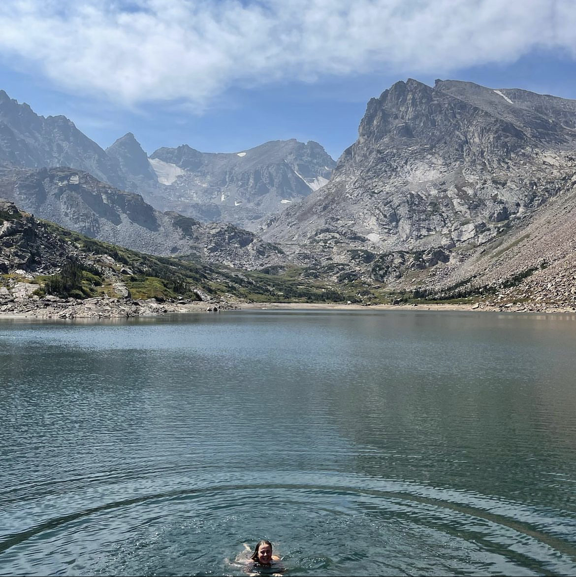
Distance: 6.6 miles (shorter routes on the same trail available)
Route Type: Partial loop, partial out and back
Drive From Denver: 1 hour 20 minutes
Location: Nederland, Colorado
Located at the Brainard Lake Recreation area near Nederland, CO, Lake Isabelle offers that classic Colorado beauty that feels timeless. The Shoshoni and Pawnee Peaks tower above the large alpine lake in the Indian Peak Wilderness making this one of the most beautiful hikes in Colorado. The hike begins at the Long Lake Trailhead, offering several options in terms of length. The loop around Long Lake makes the trek 6.6 miles, or hike straight to Lake Isabelle for a 4.5-mile hike. Lake Isabelle is the perfect spot to eat lunch and take a healing cold plunge.
The Flatirons
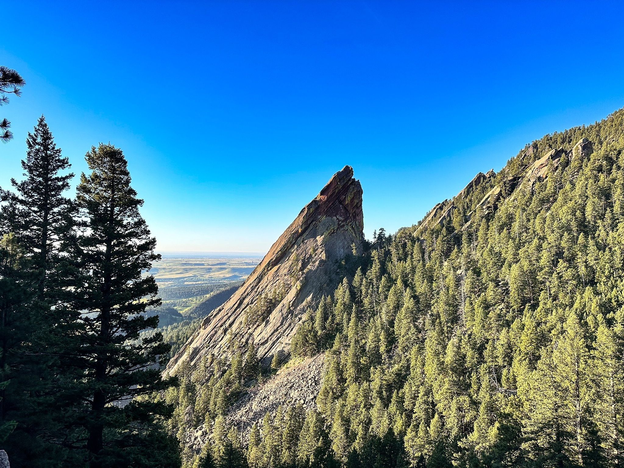
Distance: 2.6 miles
Route Type: Out and Back
Drive From Denver: Around 30 minutes
Location: Chautauqua Park, Boulder, CO 80302
Probably one of the most iconic landscapes in Colorado is the Flatirons in Boulder. One of the best ways to access the first and second Flatirons is via the Chautauqua Trail. Roughly only a 45-minute drive from Denver, this 2.4-mile hike will take you through meadows, wildflowers, views of the Continental Divide and the Flatirons rock formations. The trail has substantial elevation gain and a bit of scrambling, so come prepared to sweat in out in under three miles. This is a popular area for hiking, parking is limited and be sure to visit the City of Boulder for more information on parking and shuttles.
Green Lake Trail
Distance: 8.5 miles
Route Type: Out and Back
Drive From Denver: 4 hours
Location: Green Lake Trailhead, 620 2nd St, Crested Butte
Experience the Gunnison National Forest in Crested Butte in all its beauty with the Green Lake Trail. The trailhead starts in Big Mine Park just outside of Crested Butte, where it takes you up 1,800 feet towards Mount Axtell and directly to Green Lake. The trek is well worth it for the views and the notorious wildflowers in the months of July and early August. It’s the perfect full-day excursion with drinks and food waiting for you in downtown Crested Butte.
Hanging Lake Trail
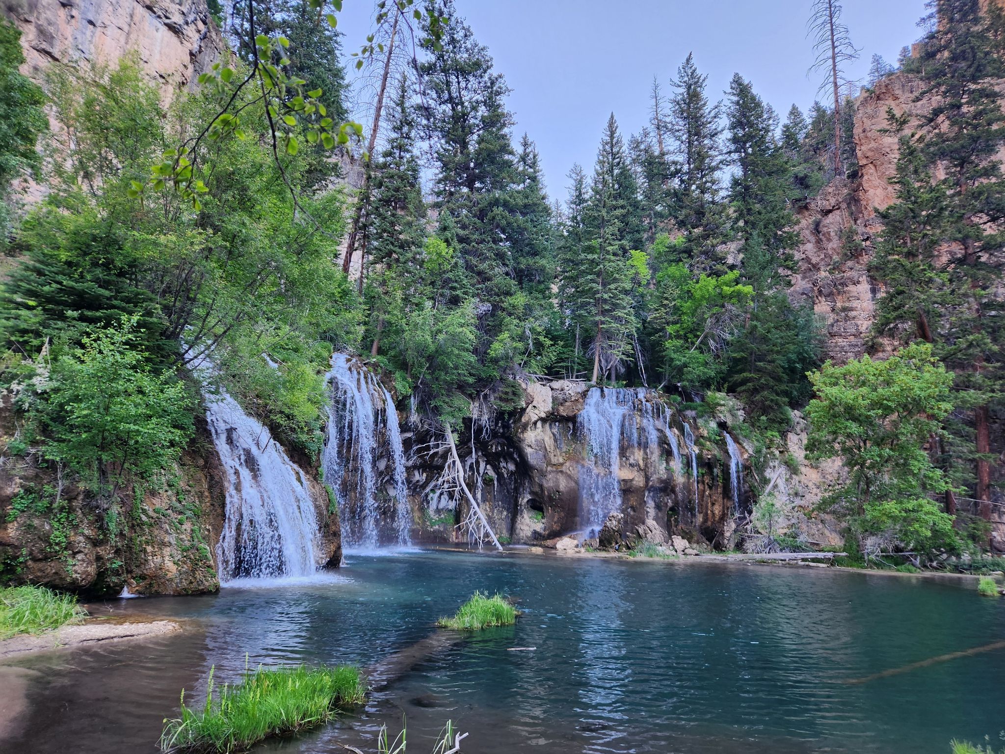
Distance: 3.1 miles
Route Type: Out and Back
Drive From Denver: 2 hours 45 minutes
Location: Hanging Lake Trail, Garfield County
Probably one of the most well-known and beautiful hikes in Colorado, Hanging Lake is a must for any visitor or local. With rugged canyons and mystic waterfalls is truly an enchanting destination. The trailhead is just off I-70 near Glenwood Springs. Walk alongside the Colorado River and towards Dead Horse Creek where the trail leads you through the dramatic canyon and eventually to Hanging Lake. Reservations are required, so be sure to book in advance and plan accordingly.