


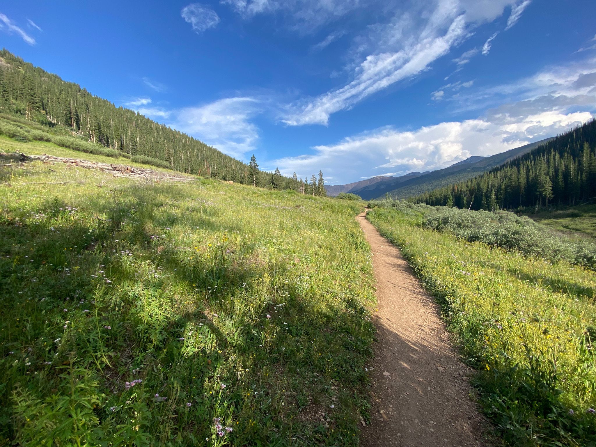
Did you know Colorado is home to nearly 39,000 trails, 42 state parks, 13 national parks and monuments? Plus, given the state’s abundant natural beauty and access to public lands, it’s no surprise that it’s been ranked the best state for hiking in 2023 based on a study conducted by KURU Footwear. The sheer number of trails in Colorado offers many options for all levels looking to experience the state’s beauty, from leisurely hikes to challenging expeditions and everything in between. Here are a few of our ten best hikes in Colorado.
Ice Lakes Trail
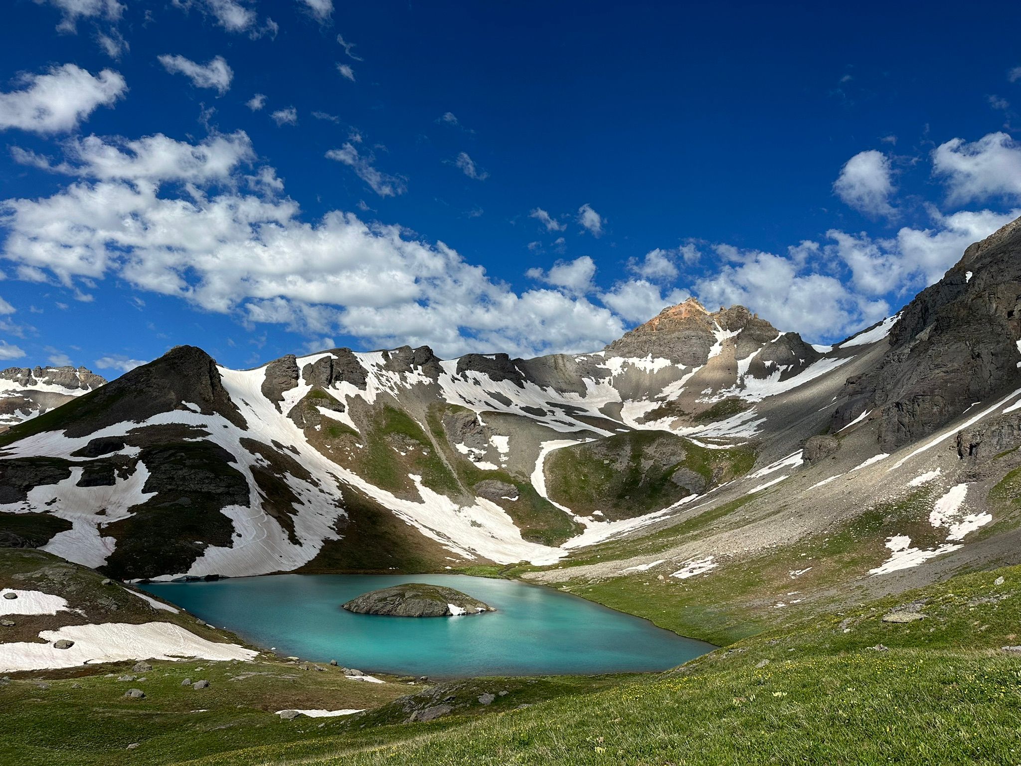
Distance: 6.9 miles
Route Type: Loop
Drive from Denver: 6 1/2 hours
Location: Ice Lake Trailhead, 806 Washington 107, Durango, CO
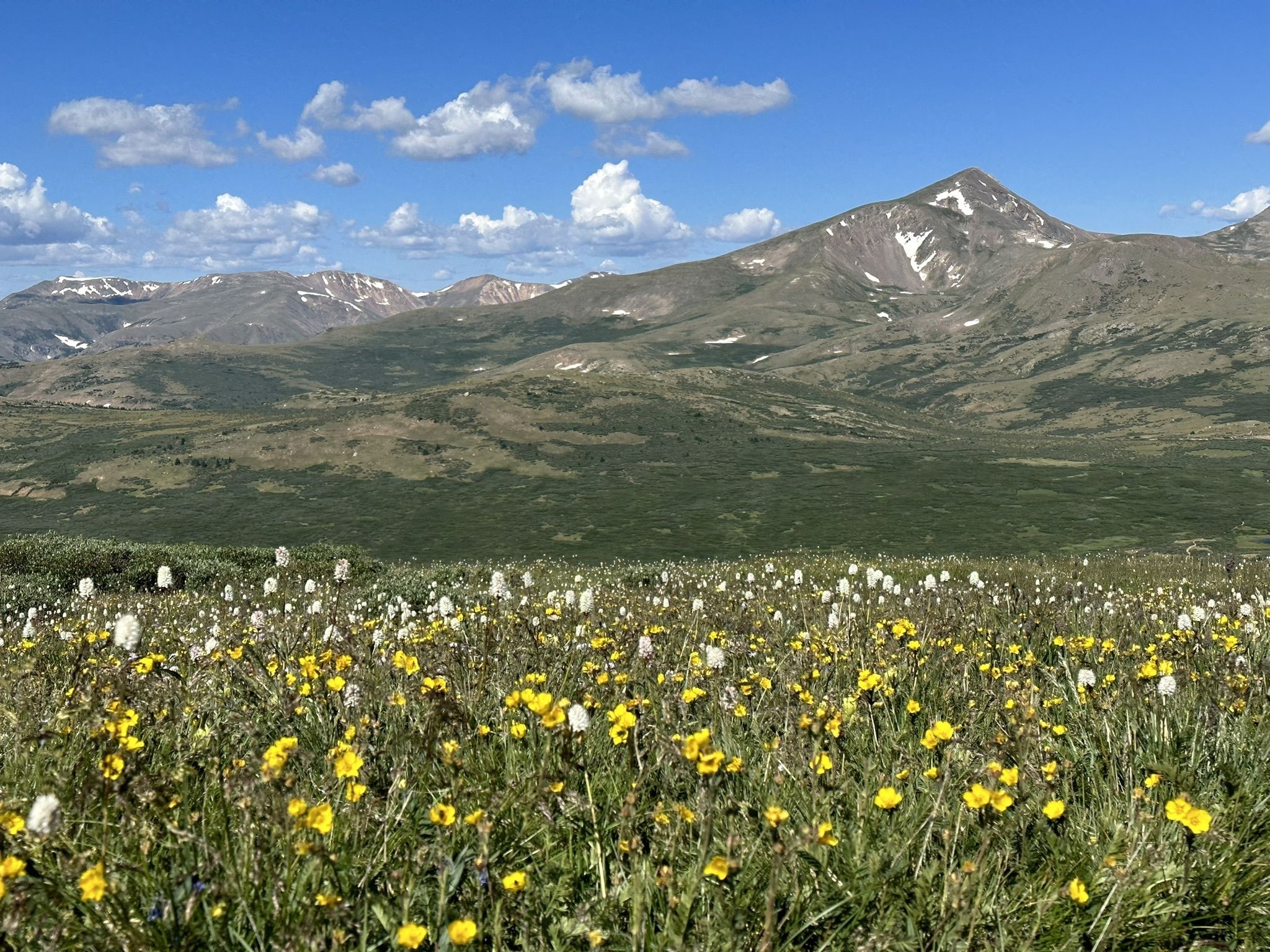
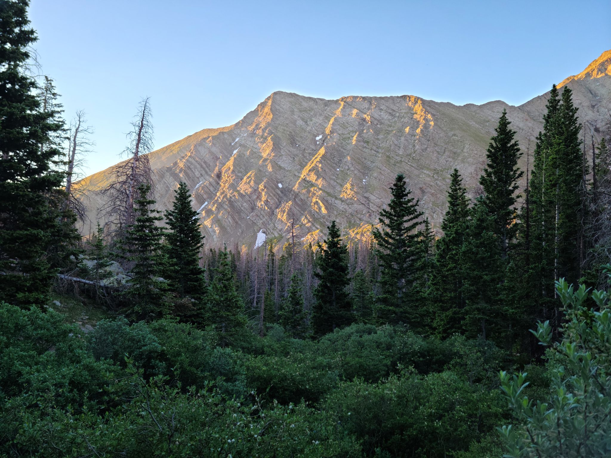
Nestled in the San Juan Mountains near the town of Silverton, the Ice Lakes Trail leads you to the crystal-blue alpine waters of Island Lake and Ice Lake. This trail is quite challenging, due to its steep terrain and high altitude gains — taking an average of about five hours to complete. The views of aspen meadows, waterfalls and wildflowers make it well worth the difficult trek.
Perkins Central Garden Trail
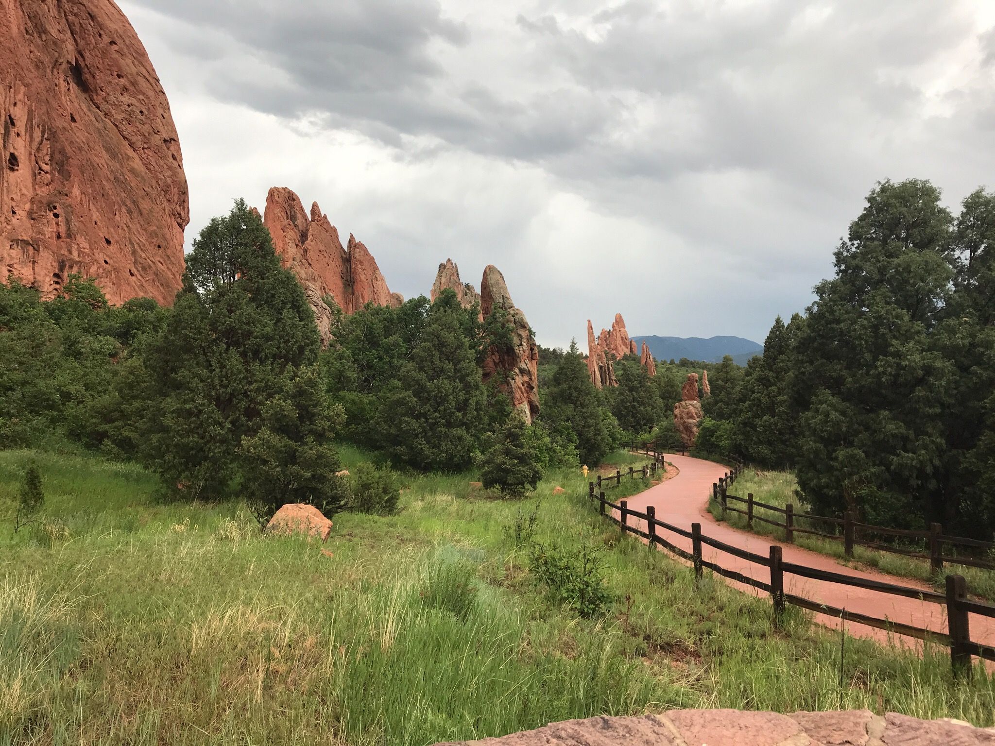
Distance: 1.1 miles
Route Type: Loop
Drive from Denver: 1 hour 10 minutes
Location: Main Parking Lot, 1423-1427 Juniper Way Loop, Colorado Springs, CO
Looking for something easy, scenic and accessible for wheelchairs and strollers? Check out the Perkins Central Garden Trail located in Garden of the Gods. This leisurely, paved trail takes about 25 minutes to complete and offers beautiful views of rock formations such as White Rock and Kissing Camels. The park offers 15 miles of trails, so there are plenty of options for all levels.
Hanging Lake Trail
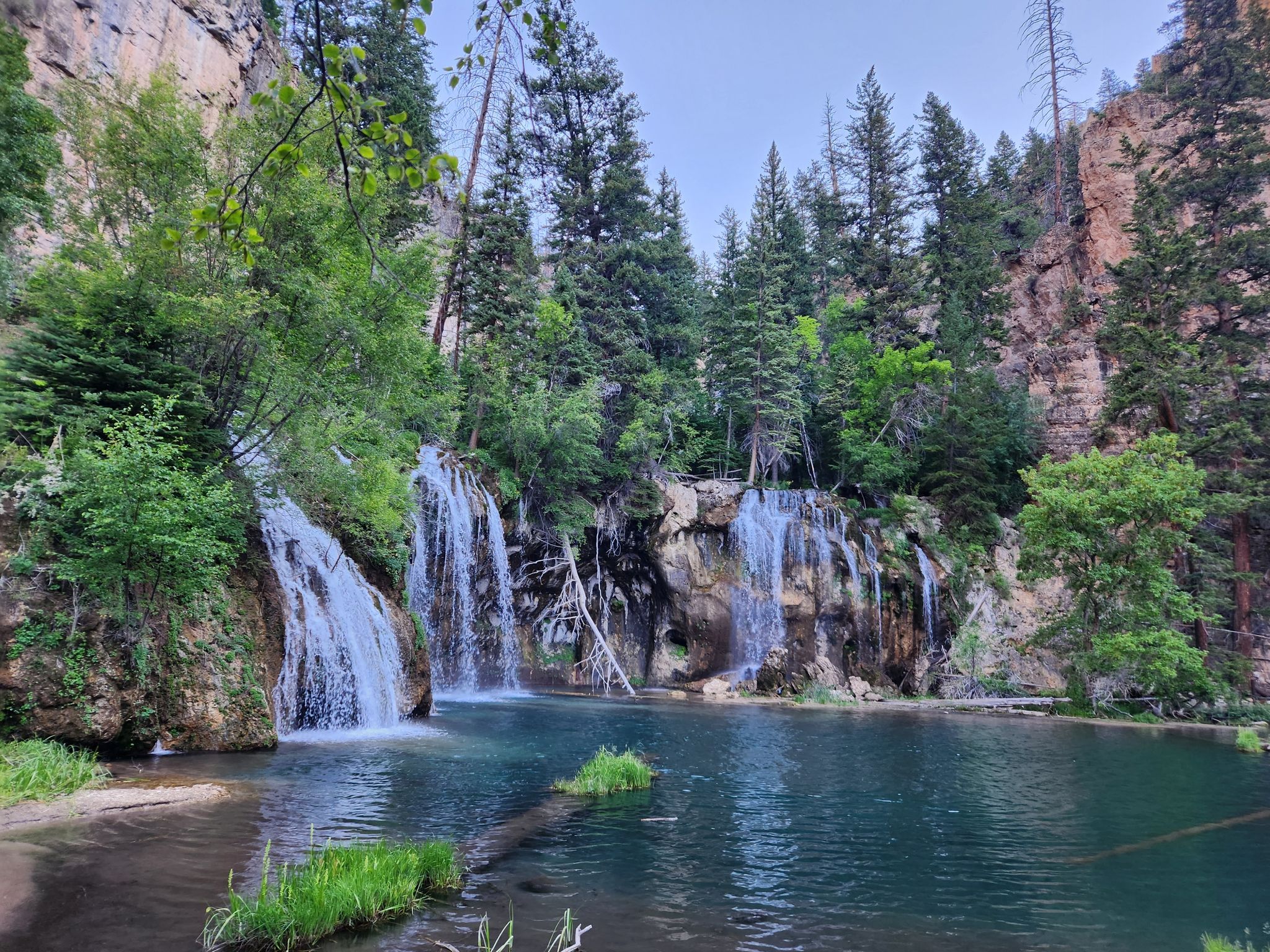
Distance: 3.1 miles
Route Type: Out and Back
Drive from Denver: 2 hours 45 minutes
Location: Hanging Lake Trail, Garfield County, CO
Hanging Lake is a rare and unique rock formation located in Glenwood Canyon, just off I-70 near Glenwood Springs. The trail is moderately challenging, with steep, rocky terrain and an elevation gain of 1,200 ft. Known as one of Colorado’s most beautiful short hikes, it takes approximately two hours to complete and offers stunning views of the surrounding White River National Forest, the Colorado River, and the dramatic Glenwood Canyon. Reservations are required, so be sure to book in advance.
Sky Pond Trail
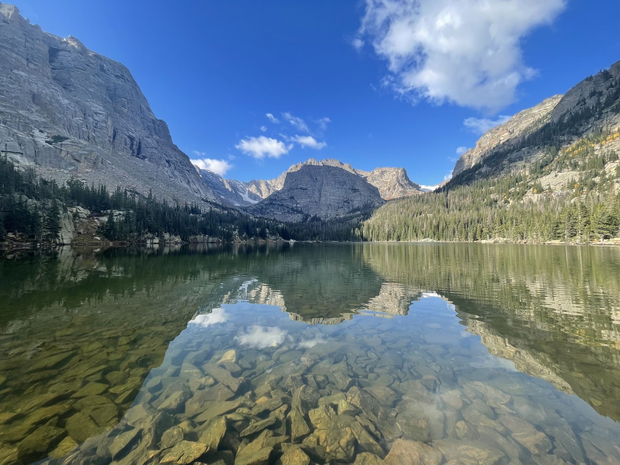
Distance: 8.6 miles
Route Type: Out and Back
Drive from Denver: 2 hours 20 minutes
Location: Glacier Gorge Trailhead, Bear Lake Rd, Estes Park, CO
If you’re looking to hike within Rocky Mountain National Park, Sky Pond, via the Glacier Gorge Trail, is a must-see. This 8.6-mile hike offers some of the prettiest views in the national park, including sights like Alberta Falls, Loch Vale, Lake of Glass and Timberline Falls. Rocky Mountain National Park requires a reservation to enter, which you can purchase here.
Mount Bierstadt Trail
Distance: 7.2 miles
Route Type: Out and Back
Drive from Denver: 1 hour 30 minutes
Location: Guanella Pass Rd, Idaho Springs, CO
Mount Bierstadt is generally considered one of the easiest fourteeners to hike, but the elevation gain of 2,736 feet makes this 7.2-mile hike through the Mount Evans Wilderness challenging, nonetheless. The rewarding feeling of completing a fourteener is only rivaled by the awe-inspiring views you’ll encounter along the way, including the Front Range, Grays Peak, Torreys Peak, and the summit of Mount Evans.
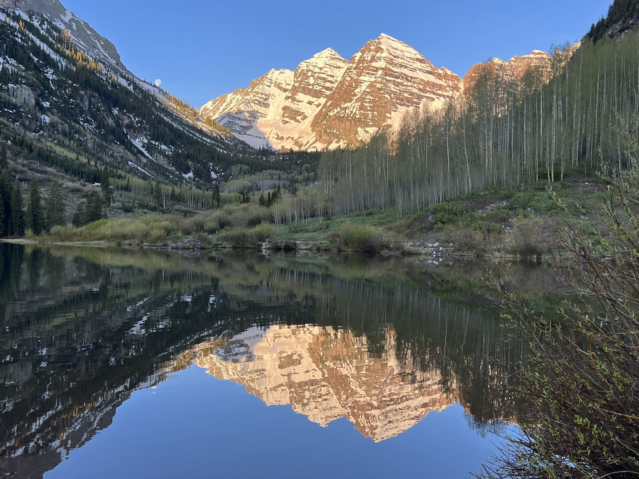
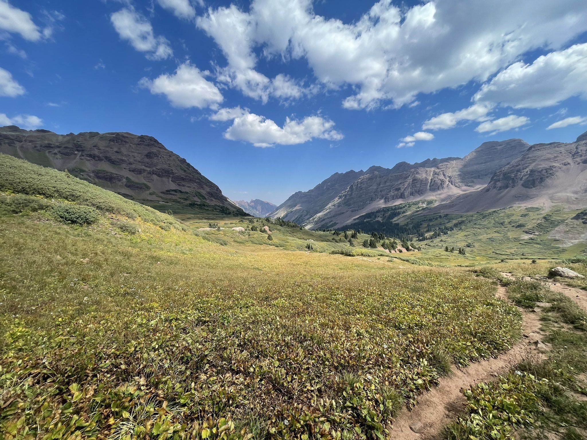
Maroon Bells Scenic Loop
Distance: 1.9 miles
Route Type: Loop
Drive from Denver: 3 hours 40 minutes
Location: Maroon-Snowmass Trail, Aspen, CO
This easy, scenic loop trail offers views of the most photographed mountains in North America, the Maroon Bells in Aspen. This hike takes you on a leisurely stroll around Maroon Lake, with views of the White River National Forest and the distinct bell-shaped, wine-colored peaks of the Maroon Bells. For hikers seeking something more rigorous, the area offers various other trails. Parking and shuttle reservations are required from May-October.
Herman Gulch Trail
Distance: 6.5 miles
Route Type: Out and back
Drive from Denver: 1 hour
Location: Herman Gulch Trail, Dillon, CO
If you’re looking for a challenging route not too far from Denver, look no further than Herman Gulch Trail, located near Silver Plume. This popular hike takes about four hours to complete and allows you to take in beautiful meadows, Herman Lake, the surrounding Arapaho National Forest and the towering Pettingel Peak as you hike. This is a hike that is especially beautiful in July and early August during the wildflower season.
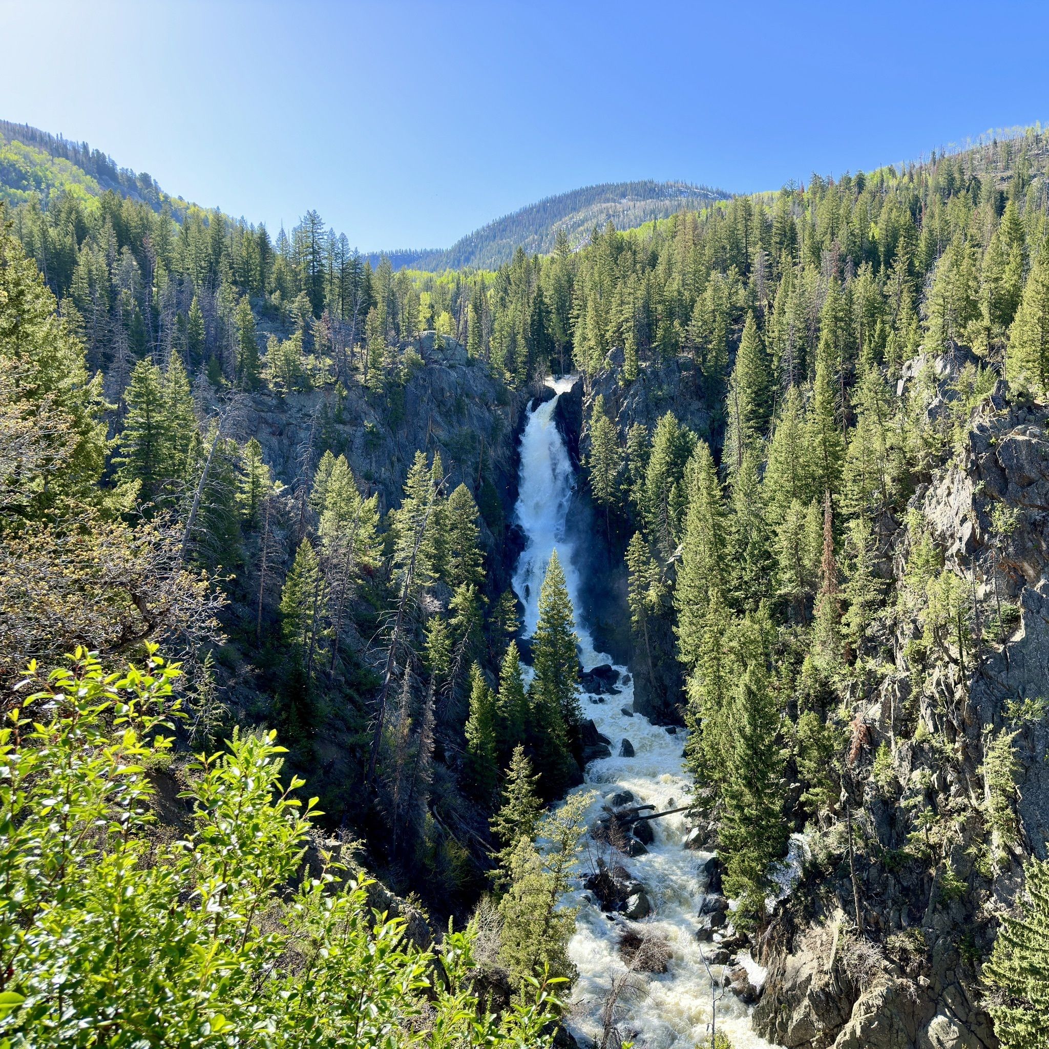
Fish Creek Falls Trail
Distance: 4.5 miles
Route Type: Out and back
Drive from Denver: 3 hours
Location: 34165 Fish Creek Falls Rd, Steamboat Springs, CO
Fish Creek Falls is a 283-foot waterfall located just outside Steamboat Springs. This challenging trail has an elevation gain of 1,437 feet and takes you through the Mount Zirkel Wilderness and the Lower and Upper Fish Creek Falls, streaming with clear, alpine water. There is also the Fish Creek Overlook Trail, for those looking for something easier and more accessible.
South Colony Lakes Trail
Distance: 9.1 miles
Route Type: Out and back
Drive from Denver: 3 hours 20 minutes
Location: South Colony Lakes Trailhead, Co Rd 120, Westcliffe, CO
This challenging, 9.1-mile hike near Crestone allows you to glimpse the South Colony Lakes, a set of backcountry waters in the Sangre de Cristo Wilderness Area of the San Isabel National Forest. In addition to the three major lakes, you’ll also get to see summer wildflowers and a wide range of Rocky Mountain wildlife. Additionally, three of the area’s fourteeners, Humboldt Peak, Crestone Needle and Crestone Peak, can be accessed from the trailhead.
Aspen to Crested Butte
Distance: 11 miles
Route Type: Point to point
Drive from Denver: 4 hours
Location: Maroon-Snowmass Trail, Aspen, CO
For more experienced hikers, this popular trek takes you on a breathtaking route along the 12,500-foot West Maroon Pass from Aspen to Crested Butte. The trailhead begins at the entrance of the Maroon Bells-Snowmass Wilderness Area and takes you past Maroon Lake, Crater Lake, giant aspen groves, colorful wildflowers and surrounding fourteeners. Eventually, you’ll finish your scenic adventure at the West Maroon Trailhead on the Crested Butte side, about 11 miles outside town. It is recommended that you book a shuttle to get into Crested Butte. Don’t forget that in order to enter the Maroon Bells, you need a reservation.