


Known for its easy-access slopes for Denverites, Summit County is a top ski destination. But during the summer and fall, it is also a haven for day hikes. Enjoy the last bit of summer with these day-trip hikes in Summit County.
Sallie Barber Mine Trail
Golden Horseshoe Trail System
Level: Easy
Length: 2.8 miles
Elevation gain: 393 ft.
Route type: Out & back
For an easier route and leisurely stroll, one of the best hikes in Summit County is Sallie Barber Mine Trail. The trail should take an estimated hour and 15 minutes to complete. If you decide to take on a longer journey, there are plenty of connecting trails to choose from to keep going. Hikers will get to view the 365-foot-deep mine established in 1880 by a group of Bald Mountain miners. The mine produced zinc ore until 1909. Hikers can see the original mining equipment through the trail, along with views of the Breckenridge Ski Resort.
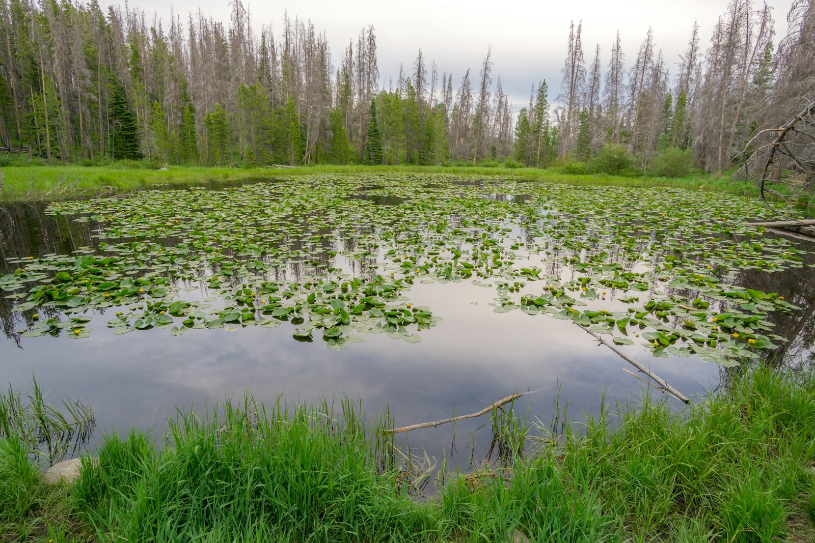
Lily Pad Lake Trail
Eagles Nest Wilderness
Level: Moderate
Length: 3.3 miles
Elevation gain: 396 ft.
Route type: Out & back
The Lilly Pad Lake Trail will bring you through lodgepole pine and aspen as you cross streams and beaver ponds near the Salt Lick Trail. You will catch views of Lake Dillon, the Dillon Reservoir and Buffalo Mountain. It is a shorter hike with moderate difficulty and will take approximately an hour and a half to complete. It may be difficult to find a parking space, so it is encouraged to consider taking the free Summit Stage bus to the trailhead. Moose may be seen, and it is best advised to not approach them.
Mayflower Lake and Mohawk Lakes
White River National Forest

Level: Moderate
Length: 7.9 miles
Elevation gain: 1,922 ft.
Route type: Out & back
This trail is estimated to take an average of 4.5 hours. Once you pass Mayflower Lake, you will continue past Continental Falls before reaching the final destination of Mohawk Lakes. The trailhead begins at Spruce Creek, which eventually turns into Mohawk Lakes Trail. You may also continue on to other lakes at higher elevations. It is suggested to arrive early at the trailhead, as parking can fill fast. This hike provides a little bit of everything: alpine lakes, old cabins, creek crossings, wildflowers and waterfalls.
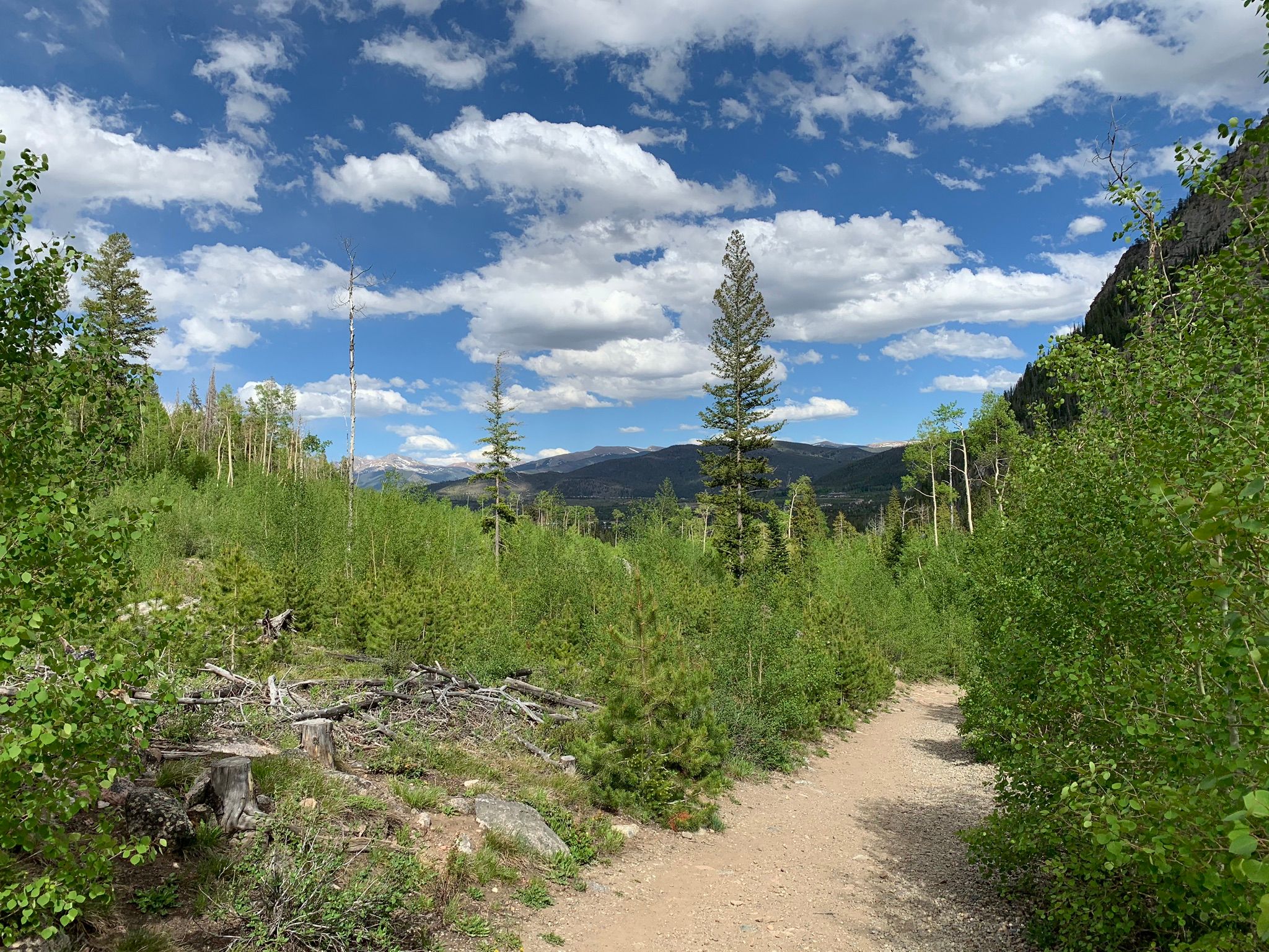
North Tenmile #37
White River National Forest
Level: Moderate
Length: 6.7 miles
Elevation gain: 905 ft.
Route type: Out & back
As you hike through the North Tenmile, you will see views of Wichita Mountain and Chief Mountain over the course of an estimated three hours. Pass through forests, creeks, open meadows and old canyons carved thousands of years ago.
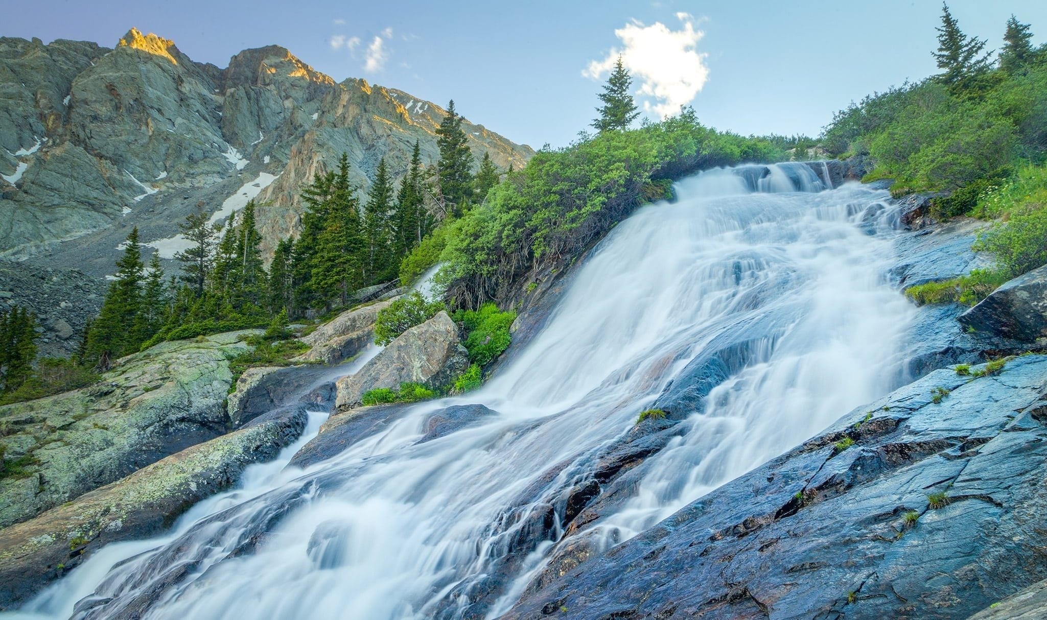
McCullough Gulch
White River National Forest

Level: Hard
Length: 6.4 miles
Elevation gain: 1,607 ft.
Route type: Out & back
If you’re hiking for the views, McCullough Gulch is just what you’re looking for. The trail features incredible waterfall views in the high alpine landscape. Additionally, you can bask in the beauty of lakes, wildflowers and mountain goats. There are rocky and muddy sections, as well as creek crossings, so be sure to wear shoes that will survive the hike. After you reach the waterfall, you will see the Upper Blue Reservoir, with the opportunity of continuing on toward the Upper Lakes. Parking at this trailhead is by reservation only, with the option to utilize the shuttle service. See https://www.parkquandary.com/ for more information.
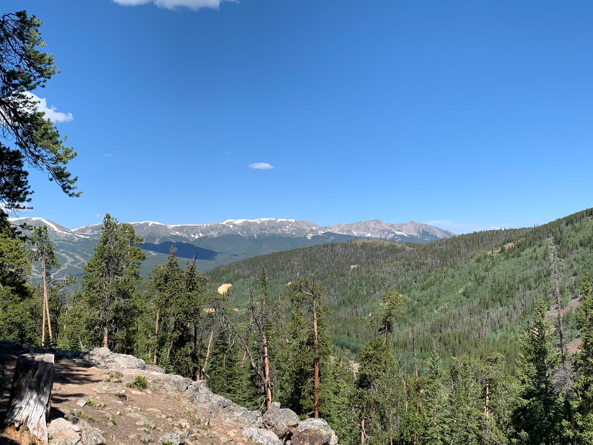
Quandary Peak Trail
White River National Forest
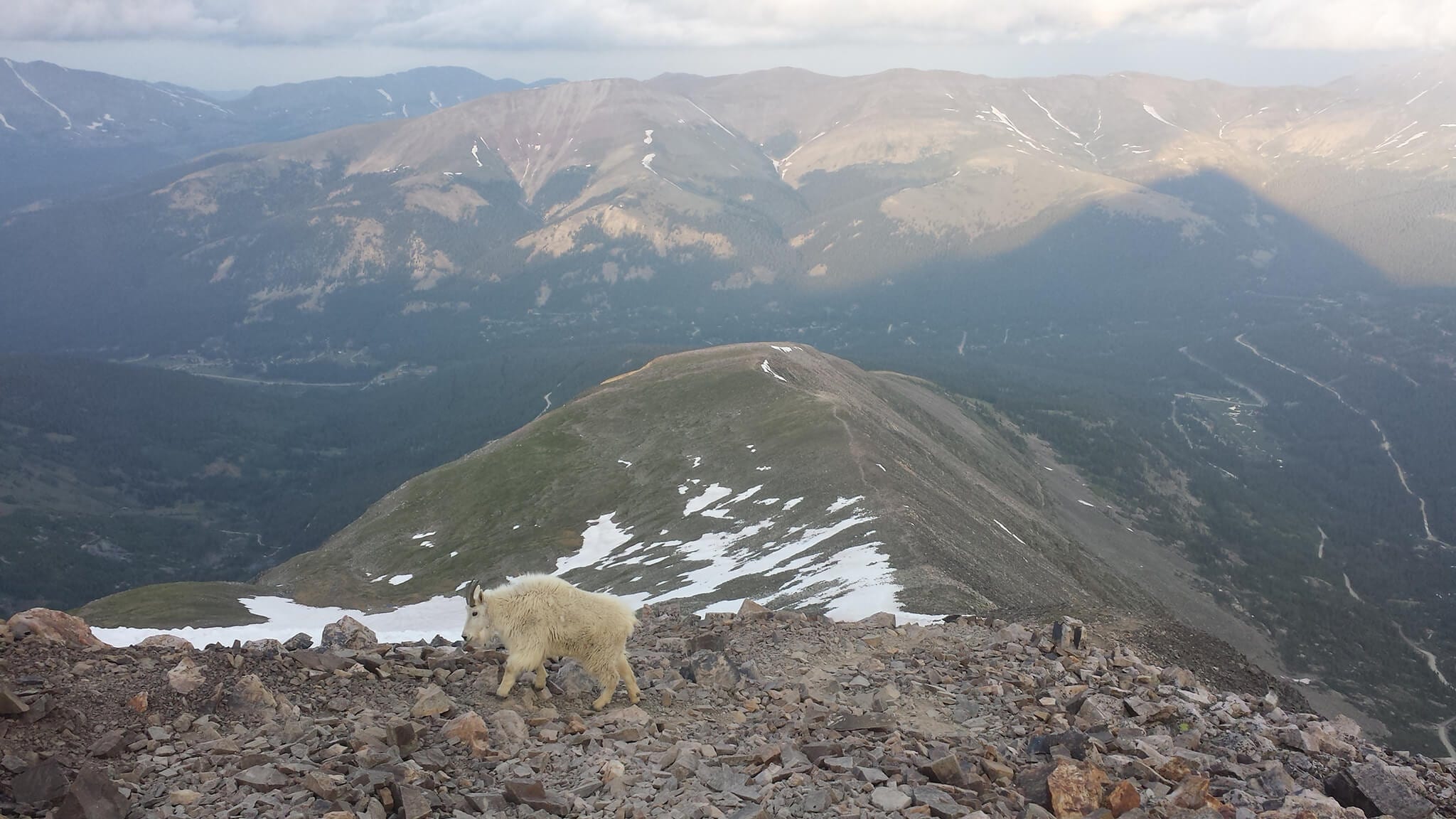
Level: Hard
Length: 6.6 miles
Elevation gain: 3,326 ft.
Route type: Out & back
Colorado is home to 58 “14ers” – mountains with a peak over 14,000 ft. Quandary is the only 14er in Summit County and its height caps at 14,271 ft. This challenging hike is estimated to take 5.5 hours to complete. Along the route, you have the chance to see mountain goats and incredible views up close. Hikers warn against bugs and mosquitos, so be prepared with bug spray. From June 17 – Sept. 17, Summit County requires a reservation to park at the trailhead. See more information on that here.
Trail Safety Reminders
When enjoying these hikes in Summit County, be sure you’re aware of who has the right of way. Hikers coming uphill have the right of way, bikers yield to hikers, hikers yield to horses or other pack stock.
Be aware of your surroundings, whether that be other people on the path or wildlife. Do not put yourself in harm’s way by attempting to get closer looks at wildlife. Always keep pets on a leash.
And as always, kindly follow the principle of “pack in, pack out,” meaning, whatever you bring into the woods and trails, bring it back out with you. In layman’s terms, dispose of trash properly, not onto the grounds.
You may want to download the trail maps ahead of time in case your phone loses service or you’re unsure of where to go at any forks. Consider starting hikes early in the morning to allow plenty of time to summit or reach the end of the trail and avoid afternoon thunderstorms.
Difficulty rating, length, elevation gain and route types come from AllTrails.com.