


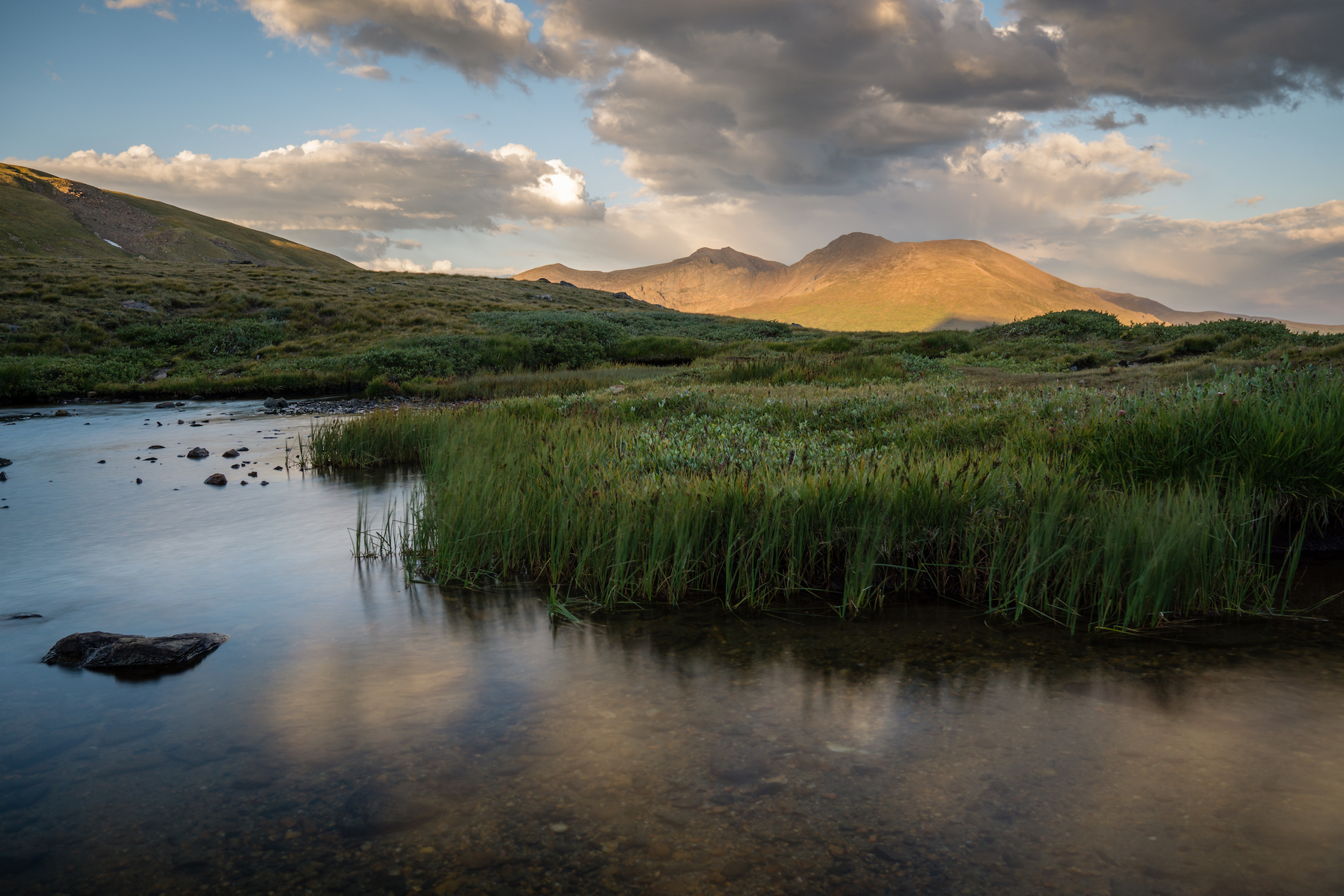
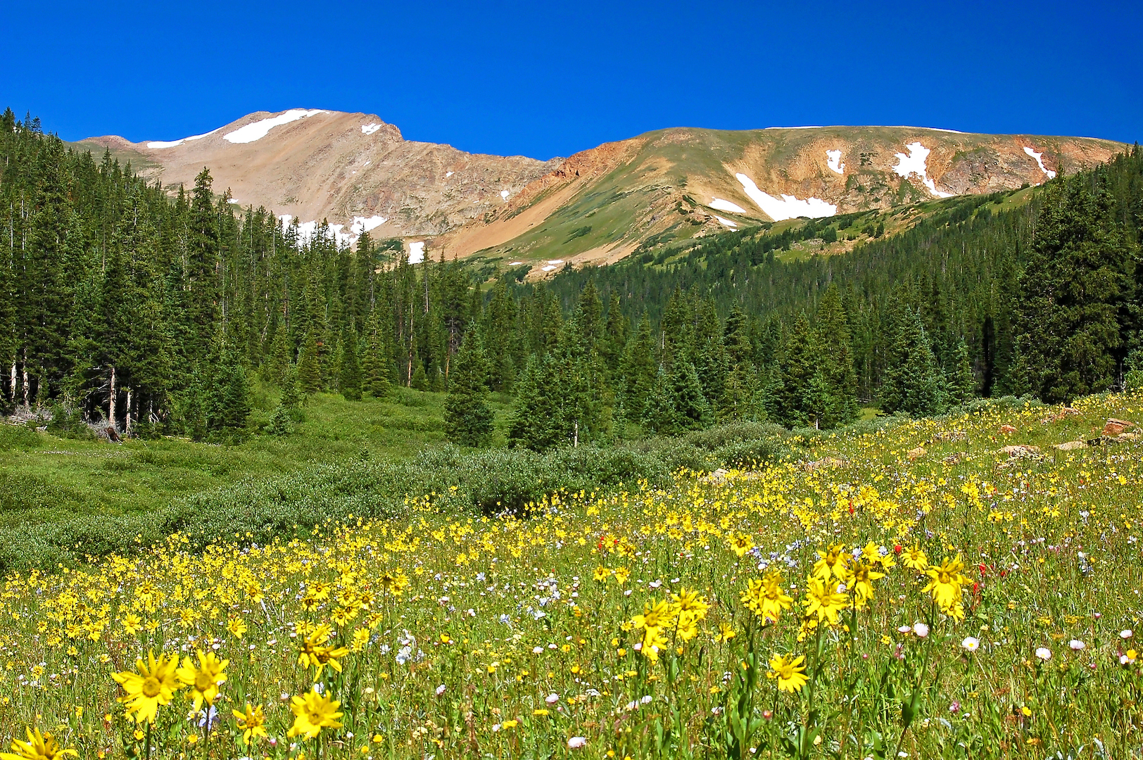
When you hike higher than 12,000 feet in elevation, there are a few things you need to know. Colorado’s ubiquitous evergreens peter out and you’ll find a completely different biome made of scrappy little plants growing close to the ground, wildlife such as pikas, marmots and ptarmigan and unencumbered alpine views. The season for hiking Rocky Mountain tundra is short, but the postcard-worthy vistas make these hikes work seeking out. High elevations can see active snowfall year-round, but June through September are usually considered the best months for alpine hiking.
Thunderstorms are the norm on summer days in Colorado and being caught above treeline when they roll in can be extremely dangerous. Start your hike early in the morning and plan to be off the mountain by midday. Always check the weather before heading out and keep an eye on the clouds.
While you may not be able to picture a hardier plant than the ones growing at 13,000 feet, don’t be fooled. They’re more fragile than they look. The saying goes “Colorado’s tundra grows by the inch and dies by the foot,” meaning that it takes a lot for the plants to grow and they are easily killed by people walking on them. Be extra vigilant with staying on the trails in alpine environments to protect the plants, and the critters that rely on them.
Ready to lace up your boots? Check out our favorite alpine hikes in Colorado and neighboring states.
Square Top Lakes, Guanella Pass
Stats: 4.6 miles, 1,012’ elevation gain
Difficulty: Moderate
Trail Map: view here
The Lowdown: You don’t have to summit a 14er to get stunning alpine views on Guanella Pass. This trail starts at the west parking lot for Mt. Bierstadt and heads in the opposite direction of the popular 14er so if you see tons of cars, don’t be too alarmed. This beautiful hike gradually climbs up to Square Tops Lakes, a great spot for a picnic. Water-loving dogs will appreciate this hike, especially in the early season thanks to the snowmelt running down the trail. Humans will want to make sure they have water-resistant boots to avoid soggy socks.
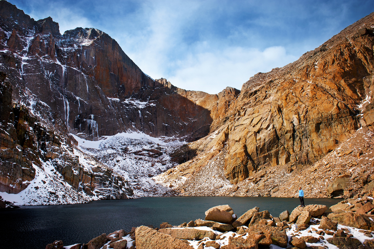
Chasm Lake, Rocky Mountain National Park
Stats: 9.4 miles, 2,601’ elevation gain
Difficulty: Difficult
Trail Map: view here
The Lowdown: This iconic trail is a bucket list item for any Coloradan. On the way to the stunning lake guarded by the Diamond, you’ll pass through evergreen forests, wildflower dotted tundra and past curious marmots and breathtaking waterfalls. You’ll share the trail most of the way with climbers headed towards Longs Peak’s famous Keyhole Route. Rocky Mountain National Park requires a timed entry reservation for the 2020 season, which can be obtained at recreation.gov, between 6 a.m. and 5 p.m. However, you’ll want to arrive earlier than that to score a parking spot in the lot to avoid parking along the road and lengthening your hike.
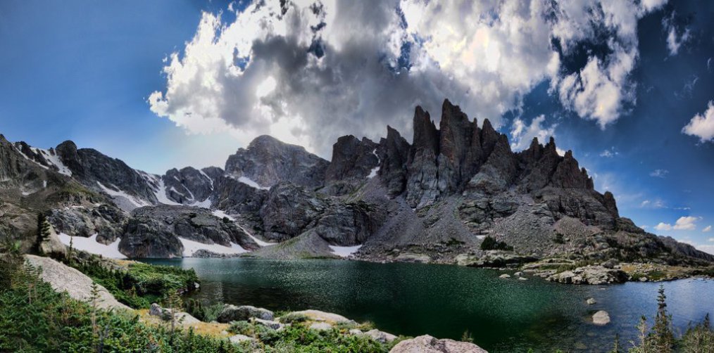
Sky Pond, Rocky Mountain National Park
Stats: 9.8 miles, 1,837’ elevation gain
Difficulty: Difficult
Trail Map: view here
The Lowdown: Another iconic Rocky Mountain National Park hike, you’ll be treated to waterfalls and alpine lakes on your way to your final destination, Sky Pond. The postcard worthy view will be worth the long, and sometimes tricky, hike in. Be prepared for a scramble that may require your hands when you reach Timberline Falls. The rocks here can often be wet, so proceed with caution and avoid the area in rain or snow. Rocky Mountain National Park requires a timed entry reservation for the 2020 season, which can be obtained at recreation.gov, between 6 a.m. and 5 p.m. If you want one of the coveted parking spots at the Glacier Gorge Trailhead, show up early, even on weekdays. If you don’t manage to snag a spot, hop on the park shuttle. The Park Service reports a slightly longer mileage than AllTrails, so we’ve included the Park Service’s mileage.
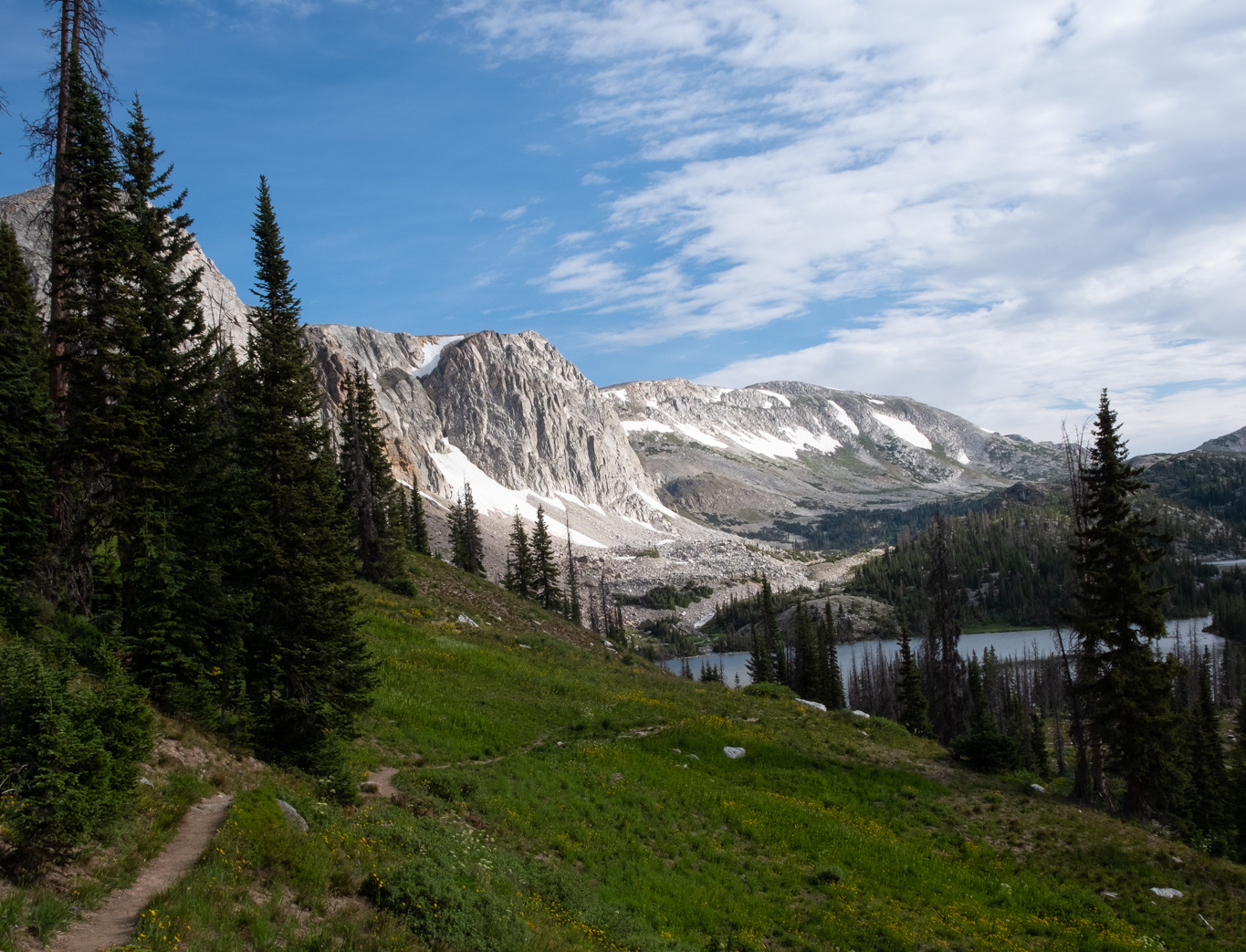
Lakes Trail Loop and Medicine Bow Peak, Medicine Bow-Routt National Forest near Laramie, Wyoming
Stats: 7.1 miles, 1,607’ elevation gain
Difficulty: Difficult
Trail Map: View here
The Lowdown: If Wyoming brings to mind a vision of lonesome prairie, head just three hours north of Denver to experience a different side of our northern neighbor. The alpine lakes and stunning peaks of the Snowy Range provide jaw-dropping views at each turn on this trail. You could simply summit 12,014-foot Medicine Bow Peak, but the Lakes Trail Loop provides a longer and more scenic trek. Start at the Mirror Lake parking area and head clockwise so you have stunning panoramic views of the lakes after summiting Medicine Bow Peak. Don’t forget your camera.
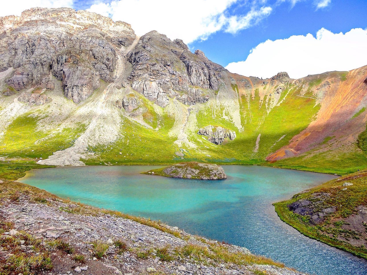
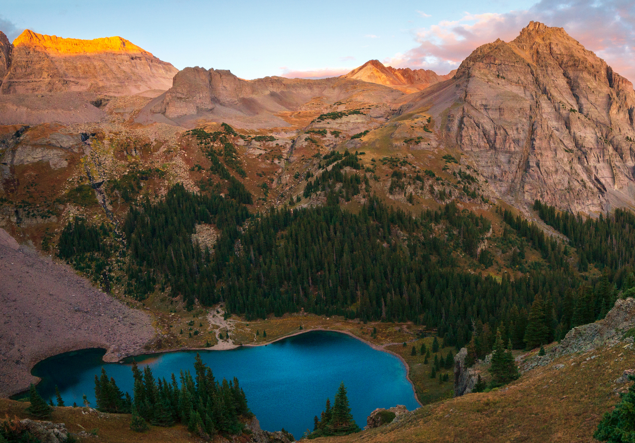
Island and Ice Lakes, San Juan National Forest
Stats: 8.2 miles, 2,762’ elevation gain
Difficulty: Difficult
Trail Map: View here
The Lowdown: No, those pictures aren’t Photoshopped. The lakes in the San Juans really are Gatorade blue. This hike treats the intrepid to two of the San Juans’ most spectacular lakes: first, Ice Lake, and then, just a half mile further, Island Lake. Along the way you’ll spot wildflowers, waterfalls and stunning alpine views. Be sure to arrive early and if the parking lot is full, don’t be tempted to park along the road or in the meadows. Besides being extremely harmful to vegetation, rangers do ticket. Note that the AllTrails description doesn’t include the bypass to Ice Lake so it is a mile short. Don’t miss Ice Lake!
Linkins Lake, Independence Pass
Stats: 1.6 miles, 528’ elevation gain
Difficulty: Easy
Trail Map: View here
The Lowdown: If simply driving over Independence Pass isn’t enough alpine wonder for you, get out of the car and stretch your legs as you get up close and personal with Colorado’s beautiful alpine tundra. While short, this trail is a bit steep, gaining over 500 feet in just over half a mile. Take your time and get rewarded with the beautiful blue waters of Linkin Lake.
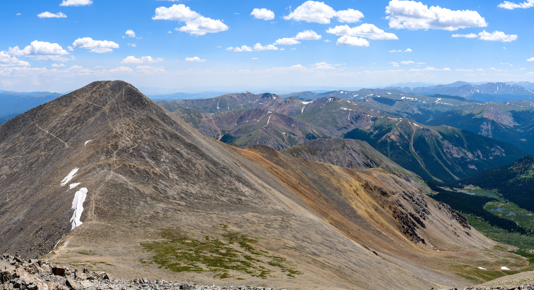
Torreys Peak, Bakersfield
Stats: 7.5 miles, 3,000’ elevation gain
Difficulty: Difficult
Trail Map: View here
The Lowdown: If you’re ready to learn what all the hype is about around Colorado’s 14ers (peaks above 14,000 feet), Torreys Peak is a great one to start with. Enjoy stunning alpine views as you climb, as well as bragging rights. After summiting Torrey’s, you can also summit nearby Greys Peak, adding just half a mile to your hike. However, if you’re talking to a purist mountaineer, know that crossing the saddle to tag the second summit doesn’t count as a full climb of Greys. The road to the summer trailhead is quite rough, so if you don’t have four-wheel drive, you’ll need to park at the winter trailhead which adds over five additional miles to your roundtrip hike.
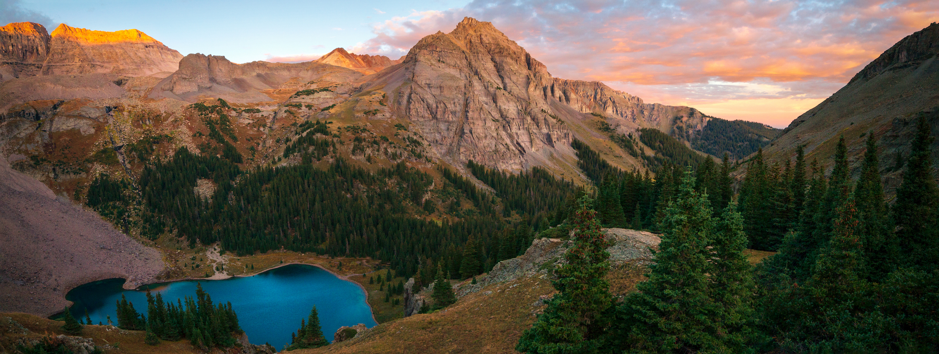
Blue Lakes, Mount Sneffels Wilderness
Stats: 6.3 – 11 miles, 1,590’ – 3,650’ elevation gain
Difficulty: Difficult
Trail Map: View here
The Lowdown: This choose-your-own-adventure hike features more of the San Juans’ unbelievably blue alpine lakes. Under the shadow of Mt. Sneffels, hike to Lower Blue Lake (6.3 miles roundtrip), Upper Blue Lake (8.2 miles roundtrip) or Blue Lakes Pass to get a stunning view down on the two lakes below (11 miles roundtrip). Be prepared for stunning wildflowers and unparalleled views. If you’re using navigation, be sure you’re headed to the correct trailhead as there is also a Blue Lake near Bridal Veil Falls in Telluride.
Mayflower Gulch, White River National Forest
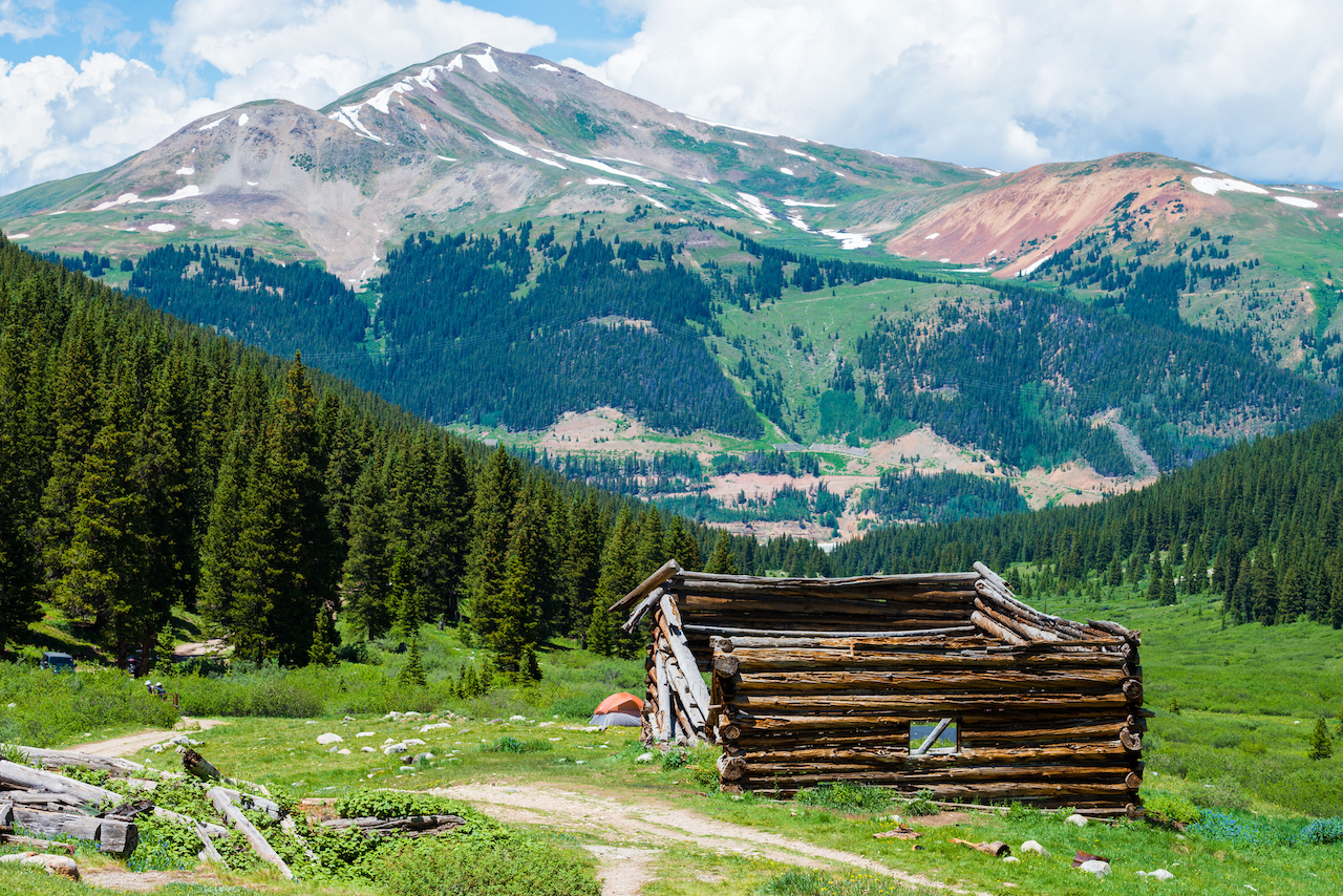
Stats: 3.2 – 5.1 miles, 1,419’ elevation gain (full trail)
Difficulty: Easy
Trail Map: View here
The Lowdown: Follow a 4×4 road through the forest for just 1.6 miles and you’ll come into a stunning amphitheater and the ruins of Boston Mine. This makes for an easy adventure or, continue on past the mine for beautiful views of the creek, the surrounding peaks and more ruins, including cables, of the Boston Mine. If you have a four-wheel-drive vehicle, you can drive up to the amphitheater, but this is a popular trail and you’ll encounter many hikers. You, and the others on the trail, will have more fun if you park in the parking lot just off Hwy. 9.
Herman Gulch, near Loveland Ski Area
Stats: 7 miles, 1,781’ elevation gain
Difficulty: Moderate
Trail Map: View here
The Lowdown: Ever wondered what all the cars parked just east of the tunnel on I-70 are up to? Pull off to find out. This trail starts in the forest on an old saw mill road but quickly opens up to stunning alpine views. At the end of the hike, you’ll be rewarded with a rest on the shores of Herman Lake. This one’s easy to access and can get crowded, so arrive early to beat the masses.