


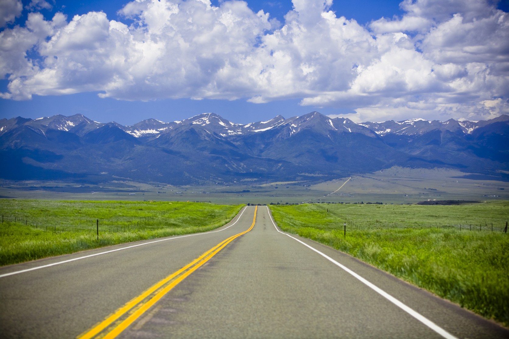
If you’ve ever taken a road trip, you know there is a fine balance between getting from point A to point B and enjoying the journey. Some might say that the only way to travel through America is via scenic byways — or roads that hold archeological, cultural, historic, natural, recreational or scenic significance. Colorado has 26 designated scenic byways, 11 of which are America’s Byways. That means Colorado holds more nationally recognized byways than any other state. And that screams road trip potential, to us.
Although the dedicated few might take it upon themselves to drive on every single Colorado scenic byway, we’ve made a mapped guide to discovering and exploring 10 of them, in succession. From the Pawnee Grasslands in the north to the Santa Fe Trail in the south, each stretch holds its own stories, landscapes and things to do, which we’ve explained. Each segment is connected to another segment, although there are multiple routes to take in some instances. Take note that some scenic byways are only open seasonally (especially this year with more snowpack and summer snowstorms in the high country) and most of them have lower speed limits than highways and interstates.
Those scenic byways are calling, and as long as you’re okay with occasionally getting stuck behind an RV, you should answer.
COVID-19 note: make sure to check with county rules and regulations before you go, as some areas may be closed or have new restrictions
Approximate time to complete: eight days to two weeks
Gold Belt Tour
Heading south on Highway 285 from Denver, you’ll reach the town of Buena Vista. In this town, you’ll find the Arkansas River, gorgeous hiking trails, lakes and a whole host of other outdoor pursuits. Stop in for an outdoor movie at Comanche Drive-In, where films are played with the backdrop of the Rocky Mountains (and it might be the highest drive-in theater in the country, at almost 8,000 feet).
Leaving Buena Vista on Highway 24 and heading to Florissant, you’ll near the start of the first scenic byway of the trip — the Gold Belt Tour. The entire stretch is 131 miles and, according to the Colorado Department of Transportation (CDOT), roughly takes five hours to complete. As the name suggests, the road tours the area where the biggest gold boom ever occurred in Colorado, passing through Cripple Creek, Florence, McCourt, Adelaide, Wilbur, Victor and more. It’s also home to two fossil areas — the Florissant Fossil Beds National Monument and the Garden Park Dinosaur Fossil Area.
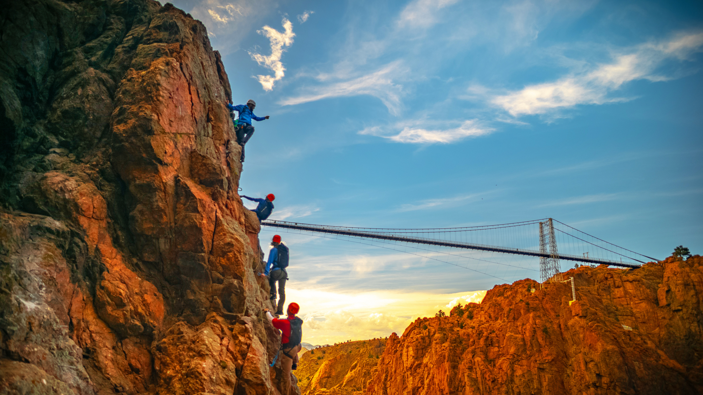
Stop for the night in Cañon City — on the south end of the Gold Belt Tour — and wake up early to catch the sunrise at the Royal Gorge before crowds take over midday. This gorge stretches down over 1000 feet in some areas, making it one of the deepest canyons in Colorado. Consequently, it’s a magnet for adrenaline junkies, including BASE jumpers (doing it illegally) and even a guy who cleared it in a jet pack.
Frontier Pathways
Hopping onto Highway 50 from Cañon City will bring you to Westcliffe and the start of the Frontier Pathways scenic byway. Not only is this stretch beautiful to marvel at with big mountain peaks to the west and meadows and aspen groves as you travel east, but it’s also dotted with the remnants of every group of people who have traveled through that area in the past. During Frontier days, this area was an intersection of cultures — Native American, Spanish, French and American. Now, you can imagine how much harder they had it than us, as you cruise from one historic building to another in an air-conditioned, cushioned seat.
Although the full byway stretches 103 miles (from Westcliffe to Pueblo with a fork that leads to Rye) we are taking the route to Rye. In this town, the largest self-built castle in the country, Bishop Castle, allows interested visitors to take a peek for free. The owner, Mr. Bishop, continues to construct parts of the residence-turned-roadside-attraction on weekends.
Santa Fe Trail
Leave Rye and head north on I-25 for just a little bit to reach Pueblo. If you’ve never explored this city, take the detour now. Nestled in the streets beyond I-25, you’ll find a cornucopia of graffiti, street art, gallery art and sculptures as well as authentic Southwestern food. As one of the first cities in the state to tolerate and sometimes encourage graffiti, it offers a historic glimpse of the culture, and for many years boasted one of the largest murals in the world at the Pueblo Levee. Overall, creativity thrives in this city although you wouldn’t see it from the interstate.
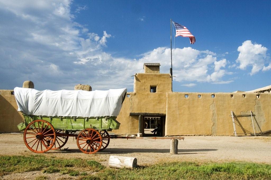
From there, head east on Highway 50 to La Junta to start the Santa Fe Trail that takes you across a vast expanse to Trinidad. This entire byway, which continues into New Mexico, is 188 miles and takes roughly four hours to traverse. According to the official description on CDOT’s website, “on a clear spring day, a sharp observer can still discern the wagon-wheel ruts of the Santa Fe Trail winding their way across the prairie ” — which is a romantic description of the drive. But the cultural legacy of this stretch can’t be denied, as it was a historic trade route in the 1800s.
If you have time to spend out of the car, take a detour south from La Junta to the Picketwire Canyon Trackway. A quarter mile of limestone deposits have preserved the tracks of several species of dinosaurs in this canyon, and with 1,300 individual imprints, it’s the largest trackway in North America. Be warned that it’s either miserably hot or cold in the middle of summer or winter, so fringe months like May and October are the best time to explore it.
The final stop on the Santa Fe Trail (for this trip) is Trinidad, on the border of New Mexico. Although it’s a small, sleepy town there’s a roadside attraction that’s worth a visit — Art Cartopia Museum. Inside this warehouse is a menagerie of wildly decorated cars plus car-themed art on the walls. It’s colorful, silly and also highly appropriate for a road trip detour.
Highway of Legends
After spending time in the plains and prairie, it’s time to head west into the Spanish Peaks and Sangre de Cristos with the Highway of Legends. This 82-mile stretch (with an extension recently added that bisects the original byway after traversing the 11,248-feet Cordova Pass) winds through the mountains while offering glimpses of Redrock features like the Dakota Wall and the Devil’s Stairsteps. The highway is a scenic legend, but it also hints at the many myths and stories that brewed from expeditions of Native Americans, conquistadors and trappers through the region. It was once said that prospectors could find a nugget of gold so rich here, it would last them an entire year.
This scenic byway is all about the drive and less about the detours. But once you reach the end of the byway at La Veta, which should take an hour or two depending on your speed, head west further for the next detour — the Great Sand Dunes National Park. If you love stargazing, you’ll want to spend a night in the sandy hills of this National Park since it was just designated as one of America’s Dark Sky parks. With little to no light pollution, it’s possible to see the cloudiness of the Milky Way from your tent. Once you hit the road again, drive to Alamosa on Highway 160 and continue on to South Fork to start the next stretch of the journey.
Silver Thread
Distinguished from the vast, sweeping and sandy landscapes of the San Juan Valley, the next scenic byway offers a winding, sometimes treacherous path through old mining camps, ending near Gunnison on Highway 50. The Silver Thread scenic byway is 117 miles in length and takes about three hours to traverse. The highest reaches — between Creede and Lake City — are still peppered with abandoned mines and intersect with the Rio Grande river. Both rugged and beautiful, this drive will remind you that Colorado has never been an easy place to tame.
Aside from the scenery, the towns along the Silver Thread aren’t bursting with entertainment but they still maintain that old mountain vibe that is quickly becoming endangered in Colorado. You’ll find kitschy activities like mini golf and outdoor recreation like fly-fishing and nature or geology walks. A short detour in Lake City will lead you on a drive around Lake San Cristobal which is the perfect spot for a picnic or stroll to loosen your car legs.
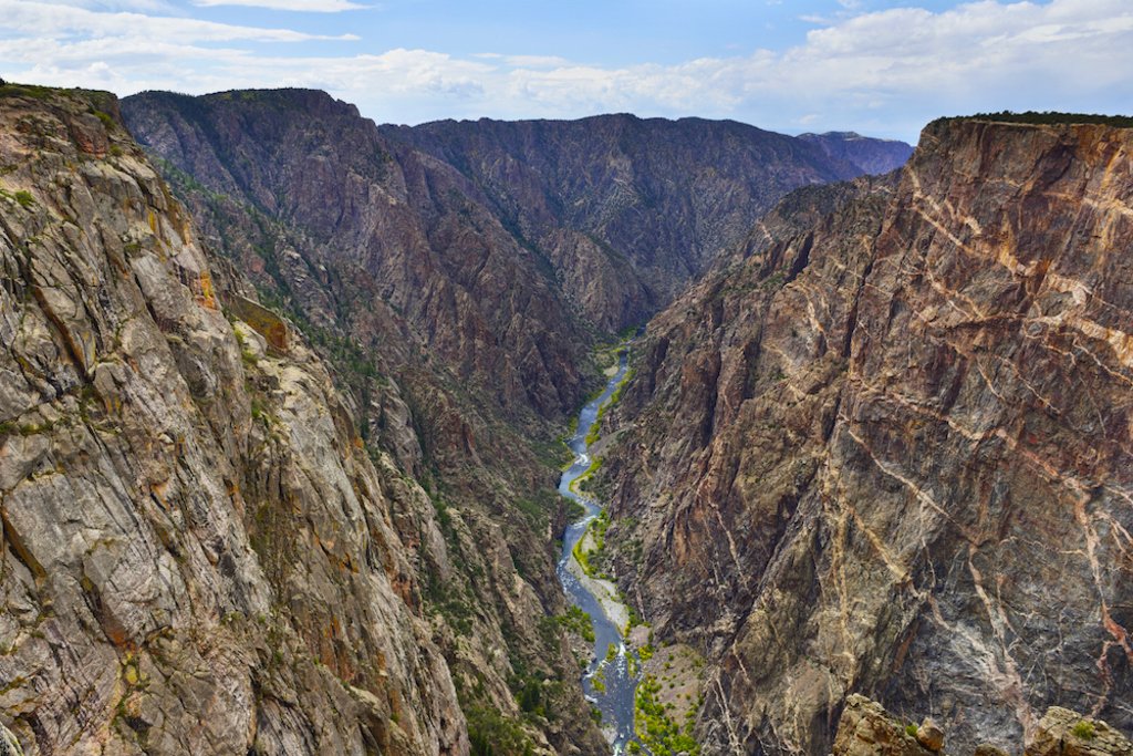
At the end of the scenic byway, when Highway 149 intersects with Highway 50, take time to explore the small college town of Gunnison — home to Western State University and the Black Canyon of the Gunnison. If you didn’t get enough of those starry Colorado skies in the Great Sand Dunes, you’re in luck because the Black Canyon is another Dark Sky park that celebrates the marvelous night sky without pollution.
Before moving further west, take one more detour into the heart of the mountains by driving to Crested Butte. Of course, in the winter Crested Butte is one of the beloved ski resorts in the Rocky Mountains. During the other times of the year, it still offers plenty of outdoor activities and boasts several summer festivals dedicated to food and booze, arts and wildflowers.
Unaweep Tabeguache
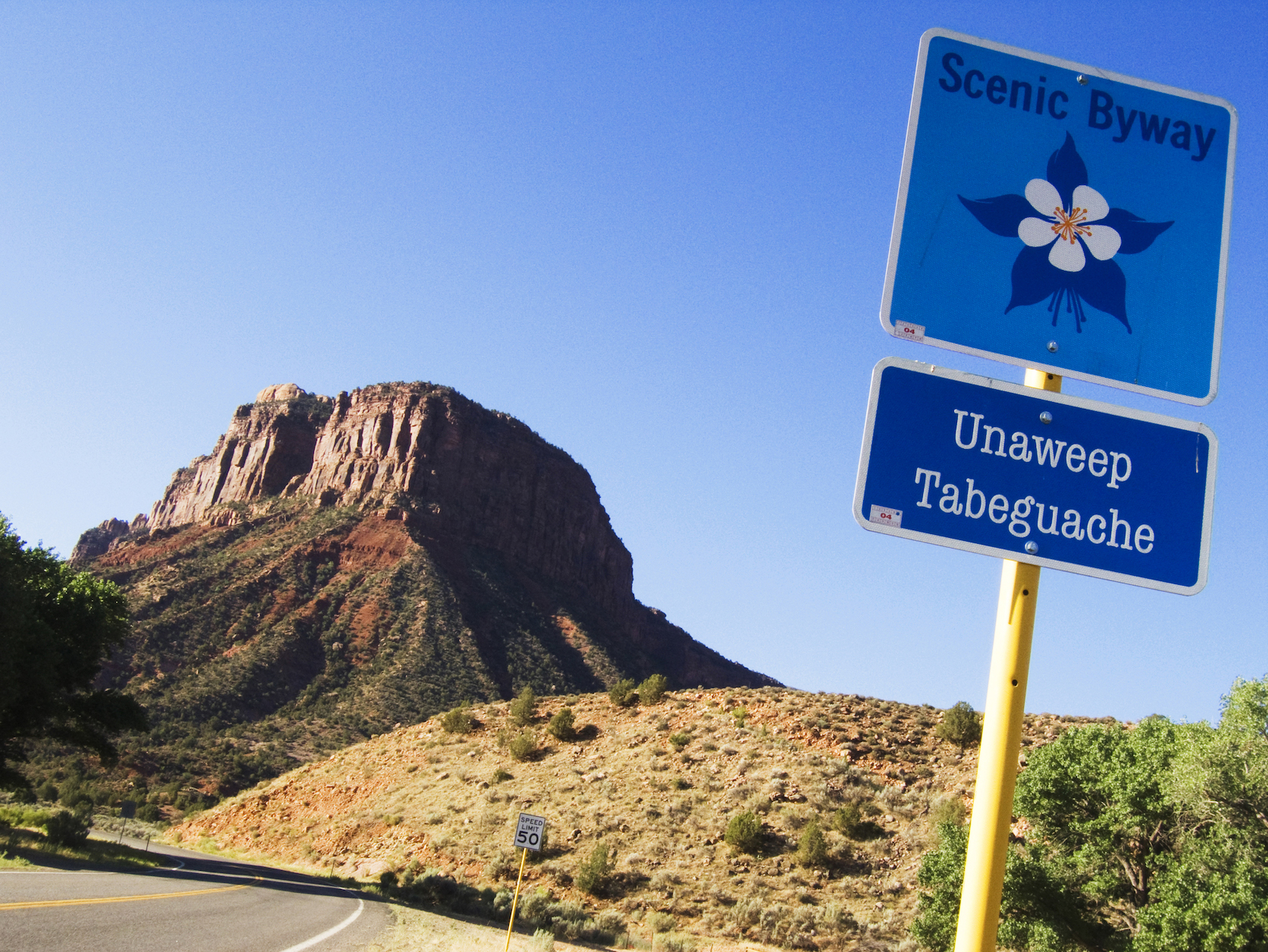
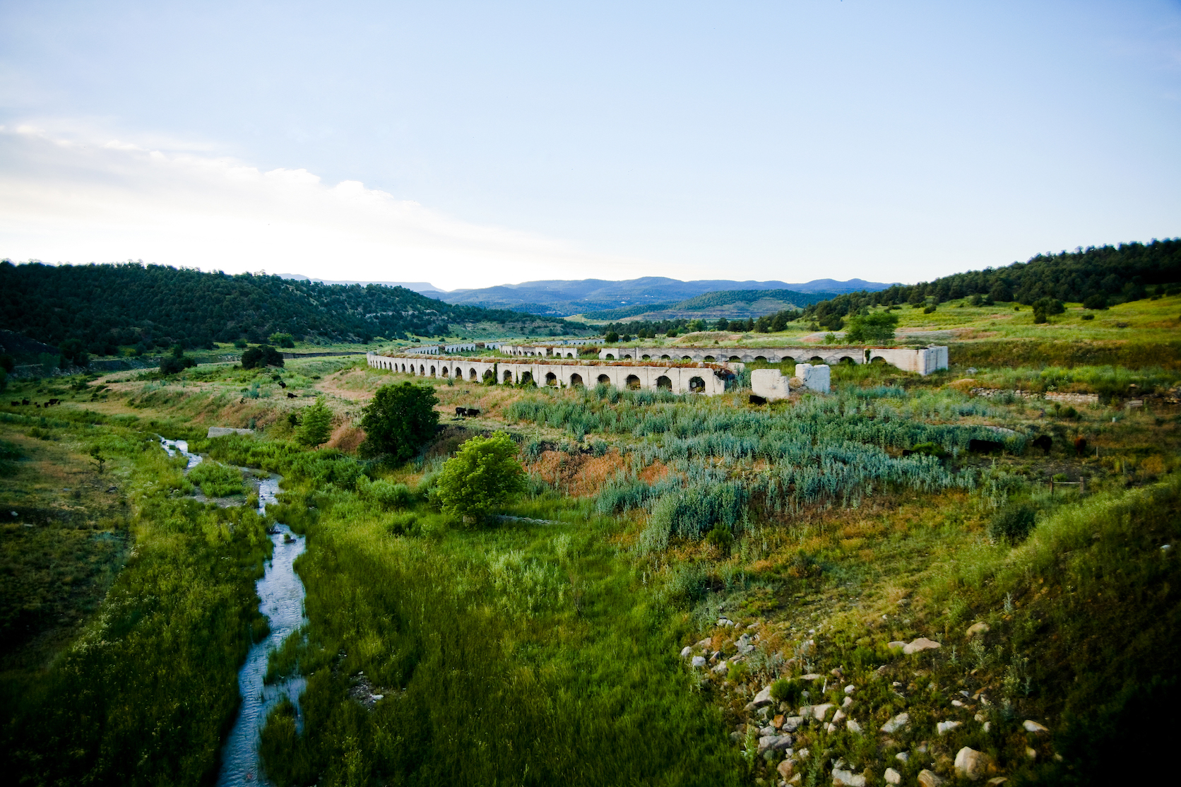
After the charm of Crested Butte, it’s time to enjoy a different side of Colorado — the plateaus and canyons of the west. Starting in Norwood and driving north next to the Uncompahgre National Forest will start the journey on the Unaweep-Tabeguache Scenic and Historic Byway — a 133-mile road that sweeps through ancient rock formations dating back to the Precambrian times. Aside from geologic history and marvels, there’s also plenty of traces of humans in the area. At different times in history, this stretch has experienced the prying hands of miners for two different substances — copper and uranium. The uranium harvested from Uravan by the US Army was used in the first atomic bombs.
Two main points of interest along the way are Hanging Flume and the Driggs Mansion. Hanging Flume is on the National Register of Historic Places after serving as a gravity-defying chute to transport water for gold placer mining in the 1880s. The 12-mile long flume hangs over the Dolores River (hence the “hanging” portion of its name) and took over three years to build with more than 25 workers. Now, the overlook found off of Unaweep-Tabeguache Scenic and Historic Byway north of the town of Naturita allows people to peer at the recently restored flume as well as the natural splendor of the canyon and the river. At mile marker 129 the stone ruins of the Driggs Mansion will appear, which holds a few odd stories within its walls — stories better discovered once you’ve seen it for yourself.
The end of the byway is in Whitewater, just south of Grand Junction. By the time you reach this point, you’ll be fully immersed in the dramatic desert landscape and a hike in Colorado National Monument will perfectly suit your state of mind. Even without getting out of the car, Colorado National Monument offers stunning views from Rim Rock Drive and is a worthy detour for anyone with a penchant for phenomenal views.
Dinosaur Diamond
Now that the desert landscape has stolen your heart, it’s time for one of the longest scenic byways in the state — Dinosaur Diamond. Before heading into the canyon country where some of the world’s most significant dinosaur fossil quarries exist, stop in Fruita for a chance to embrace its odd charm. The best example? A story about Mike the Headless Chicken accompanied by a sculpture to immortalize the inflated incident.
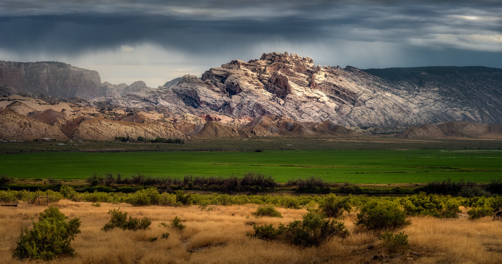
Leaving Fruita and driving north on Highway 139, the Dinosaur Diamond stretches roughly 400 miles before reaching Rangley (and continues on another 86 to Dinosaur). In those miles (which can take a few days to traverse) the road crosses rugged mountains and barren plateaus where rock and fossils that are 100 million years old scorch in the sun. Also along the way are two National Monuments (Colorado and Dinosaur) McInnis Canyons National Conservation Area and two major Western Rivers — the Colorado and the Green.
For a bizarre detour, head off Highway 139 at Rangley and west onto 64 until you reach County Road 46 to find a lesser-known attraction called The Tank. Although it’s one of the tallest water tanks in the area, it’s never been used as a water tank and instead has established a following of musicians and artists who find the acoustics of the hollowed out structure to be ethereal and sometimes transcendental.
Flat Tops Trail
Now that the desert has changed your perspective about Colorado, it’s time to go back to the mountains with the Flat Tops Trail. The Flat Tops Trail goes straight through the center of what used to be the White River Plateau Timberland Reserve — the second unit of what is now the National Forest system. Traveling from Meeker to Yampa, this road is definitely one to drive in the summer in decent weather due to its ruggedness.
Partly because of its designation as National Forest in the 1940s and partly because dedicated visitors loved the pristine condition of the wilderness, development was banned at Trapper’s Lake, which is roughly the midway point, in the early 1900s. But despite that (and due to the odd negotiations of usage of the National Forest system), you’ll see active mines, ranches and logger’s forests all along the way. That’s not to say it isn’t filled with magnificent wilderness, and the condition of the road often reminds you how excluded you are from civility.
Although Trapper’s Lake can be reached with a small detour away from the scenic byway, there’s another picturesque stop before you reach Yampa called Vaughn Lake that isn’t far from the route. During July and August, this drive will bestow almost endless opportunities to see massive blooms of wildflowers like Columbines, Bluebells, Fireweed and Indian Paintbrush.
From Yampa, the scenic byway technically ends but our journey continues to Steamboat Springs where the scenery is similar, but there’s more entertainment. Stay a night at Strawberry Park Hot Springs and receive 24-hour access to the natural hot pools nestled into the mountains (with clothing optional after dark). Or, ride the longest mountain roller coaster in North America for a rush of adrenaline before continuing on with the road trip.
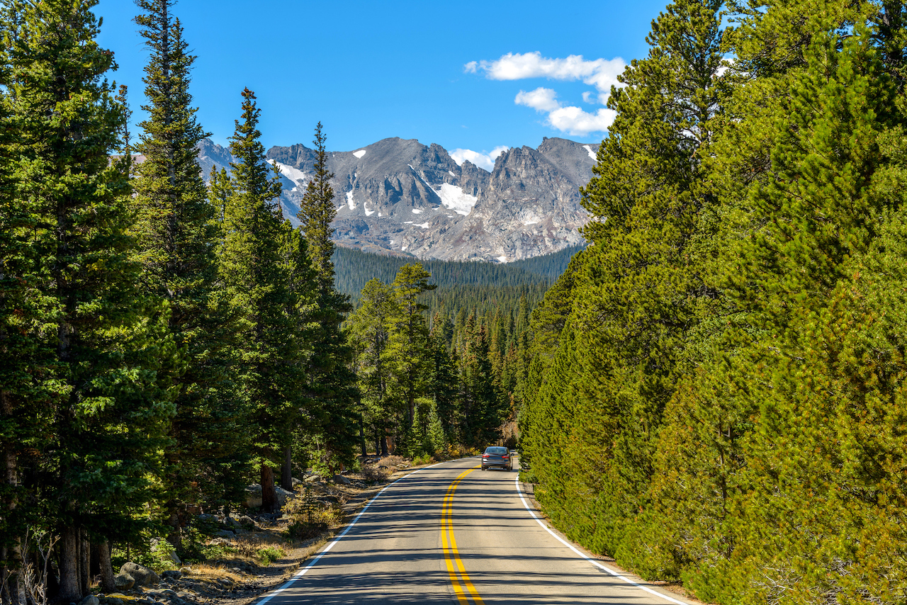
Trail Ridge Road
From Steamboat Springs take Highway 40 east toward Grand County in order to approach another scenic byway — Trail Ridge Road — from the Rocky Mountain National Park entrance. But, before that, if you have time, we highly suggest taking the longest detour of the trip to see the northern Colorado town of Red Feather Lakes. Sure, it’s going to take an entire day (two hours each way from Walden to Red Feather Lakes plus time to explore once you arrive) but if intriguing roadside attractions pique your curiosity, it is a must. Here you’ll find Gnome Road — a path peppered with forest and garden gnomes to discover — and the Great Stupa of Dharmakaya. The Stupa — or large dome structure used as a Buddhist shrine — is one of the largest in North America and meant to last 1,000 years. Reaching over 100 feet tall, the Stupa contains three levels, although only the first floor is accessible to the public.
After seeing why Red Feather Lakes is worth the detour, backtrack to Grand County via Highway 125 and meet up with Highway 40 in Granby. Before taking Highway 34 toward Grand Lake and Rocky Mountain National Park, allow an hour to check out the recently painted murals along Main Street. The eight walls were painted by 16 Denver-based street artists for a festival called RKY MTN WALLS in June. If you’re looking for more of a small-town Western vibe, there’s a real-life rodeo every Friday night at 7 p.m. in the summer just outside of Granby.
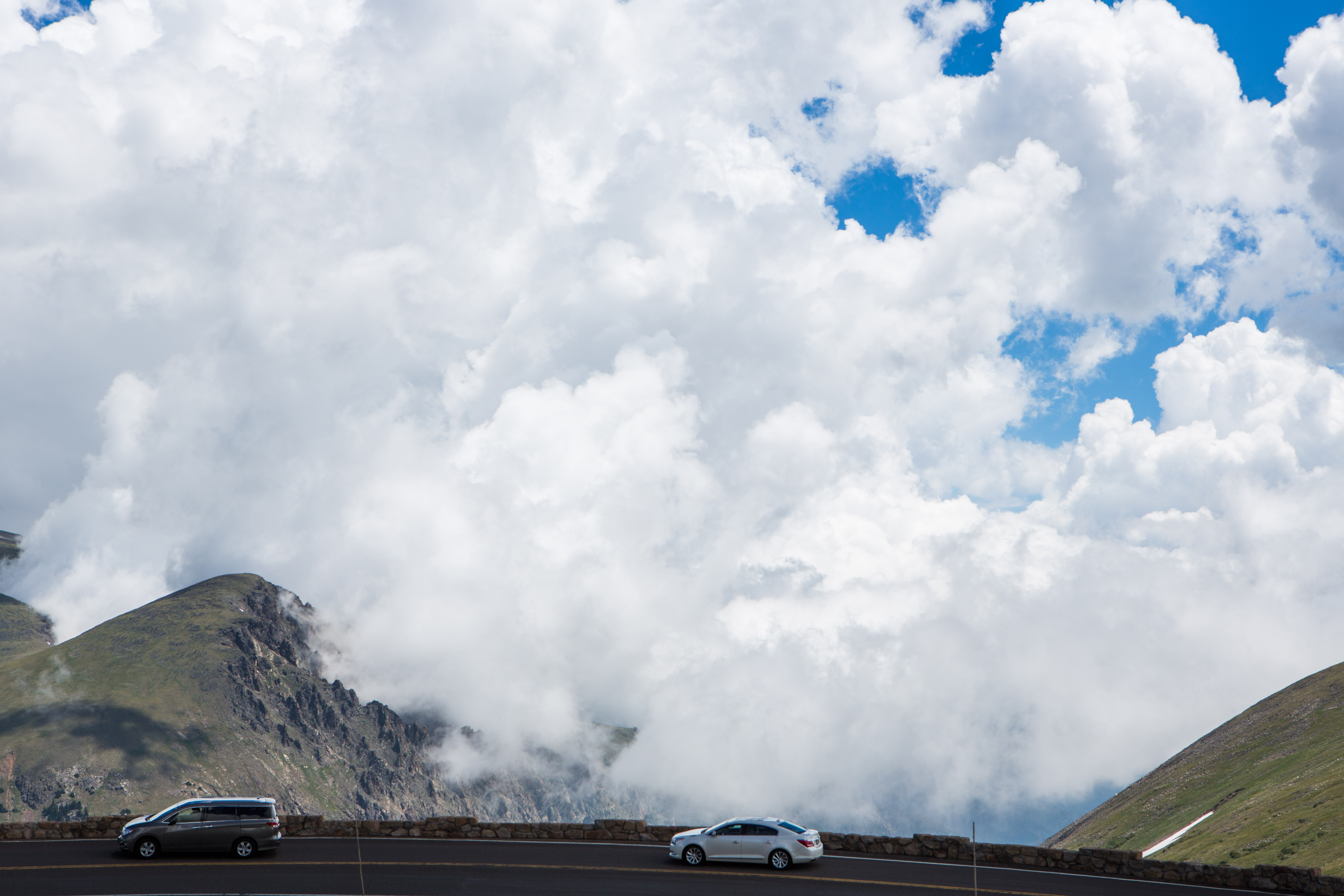
Most tourists to Grand County spend time in Winter Park or in Grand Lake — on nearly opposite sides — because those two towns hold the most quaint charm to them. So if you prefer the traditional idea of a mountain resort town, Grand Lake offers the picturesque version with old school cabins connected with boardwalks on an alpine lake. Stay the night here if you are more than halfway through your day because the drive beyond into Rocky Mountain National Park and across Trail Ridge Road can be harrowing. According to the park, the earliest opening date for this scenic byway was May 7 and the latest date was June 26, so the recent closure due to summer snow storms is not out of the ordinary.
But even with unpredictable weather, Trail Ridge Road must be traversed at some point in your travels in Colorado — simply on principle. According to CDOT, it is the highest (in elevation) paved road in the country, soaring above 12,000 feet. Hugging the sides of steep mountainous terrain, Trail Ridge offers views of magnificent peaks in all directions because it crosses the spine of the Rocky Mountains, taking you from one side of the Continental Divide to the other. At these altitudes, the road and the cars that traverse it are above treeline, exposed in an alpine landscape that is both incredibly fragile and shockingly hardy. After winding around cliff-hugging corners and spine-tingling straights, Trail Ridge eases us into Estes Park in a fitting denouement.
Pawnee Pioneer Trails
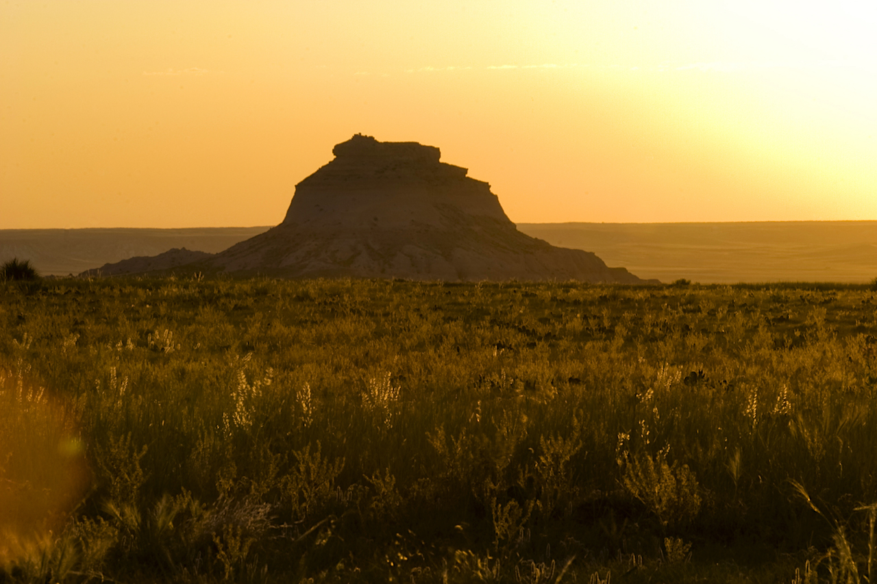
In direct contrast to the rugged high alpine terrain of Trail Ridge Road, the Pawnee Pioneer Trails accentuate the subtle magnificence of the short-grass plains of northeastern Colorado. Starting in Ault and moving from Briggsdale north to Grover, this scenic byway takes drivers across the Colorado Piedmont — a geologic and geographic region that formed roughly 28 million years ago and is lower in elevation than the foothills to the west and the High Plains east of it. Punctuated with the Pawnee Buttes, the Pawnee Pioneer Trails will make you feel a little like being on the Oregon Trail, without dysentery.
Strangely enough, even though the name suggests the road has been there for ages, pioneers did not start settling in this area until after the mountains and Western Slope experienced mining, logging and other industrial booms. Until the 19th century, Southern Arapaho and Cheyenne Native American tribes inhabited the region and white settlers avoided it until after Colorado became a state rather than a territory.
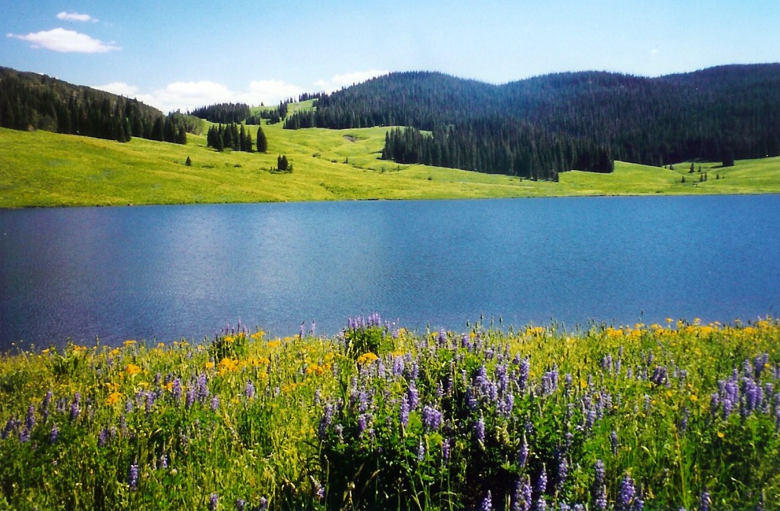
The Pawnee Grasslands are a protected area along the scenic byway stretching nearly 200,000 acres in size. However, although there are camping sites and some hiking trails (mostly to reach the Pawnee Buttes) the discovery of extractable oil and gas has significantly decreased the number of people seeking out those activities in the area. Sadly today, only about 3,000 acres are protected from natural resource development in the Grasslands — but there, the beauty of the prairie remains vibrant. Plus, the area is home to a plethora of birds and birdwatchers from all over will find excitement in the species who call it home.
The scenic byway ends in Sterling, but in this journey, we head south to the town of Last Chance — if for nothing else, to take a photo of the sign that says “Last Chance.” Before the interstate highway system took travelers through Colorado on I-70 or I-25, Last Chance was quite literally the last opportunity to stock up on food and fuel before Denver or on your way out of Denver. Now, it’s a ghost town that is quite photogenic.
Before starting the final leg of the scenic byway bonanza, the final detour in the eastern plains is to Stratton, where the highway mile marker that read 420 miles had to be taken down after it was stolen countless times. In its place now sits a mile marker sign that reads 419.99 (as if that will stop the stoners from stealing it).
Top of the Rockies
For the final stretch of this journey throughout the state, we’ll take the Top of the Rockies Scenic Byway — a short 82-mile stretch that is surrounded by 14ers. In order to get there from the eastern plains, we’ll drive through Colorado Springs (home to the Air Force Academy, Garden of the Gods and the Paint Mines Interpretive Park) and onto Highway 24 to reach the ski resort town of Breckenridge. In Breckenridge, enjoy the rapidly growing art and culture scene, with outdoor public art displays and festivals throughout the summer.
From there, it’s time to start the Top of the Rockies traverse toward Leadville — the highest incorporated town in the US by elevation at 10,200 feet above sea level. This stretch of road not only shows off the enormous peaks of Mount Elbert and Mount Massive, it also holds the rich (quite literally) history of some of the most successful mining operations in the state. The historic figure Horace Tabor became a titan of the silver industry in these mountains.
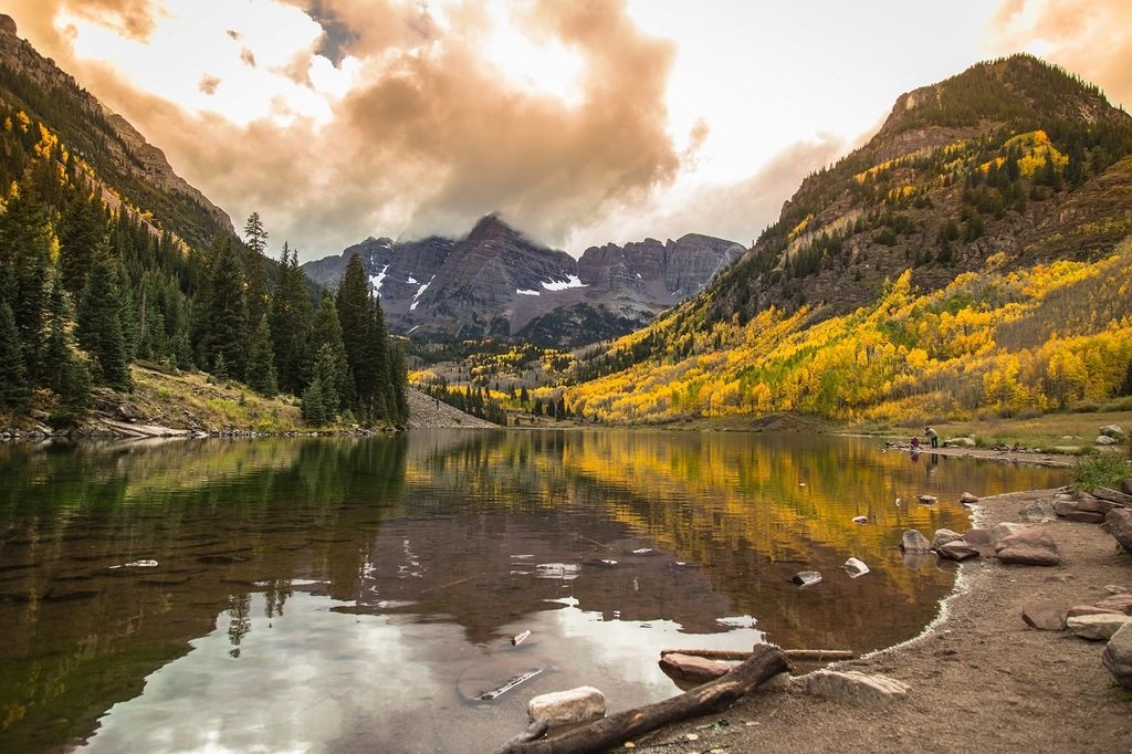
From Leadville, the scenic byway goes north to Minturn and Vail or south to Granite and west to Aspen. Either way will bring you through magnificent mountain scenery and neat towns. The southwestern portion of Top of the Rockies takes you over Independence Pass (the summit of which sits at 12,095 feet) and into Aspen, where our final detour to one of the most photographed spots in Colorado awaits — Maroon Bells. For the hardcore, the hike to the top of Maroon Bells and between the two peaks is a must-do, but for the less experienced a night in a tent at base camp will still allow for unmatched views.
Descending from the Top of the Rockies, our journey comes to an end in Glenwood Springs, where sore bodies are mended in the natural pools around town before the drive back to Denver on I-70.
Want more?
If you aren’t quite done with driving yet, there are a few more scenic byways that you can hit on your way back to Denver — Guanella Pass and the Peak to Peak Scenic Byway (which is where the main photo for this article can be found). The Peak to Peak isn’t even that far out of the way, if you take the Central City Parkway exit from I-70 after Idaho Springs, it will loop you around to Boulder in just an hour or two. Plus, it holds plenty of interesting sites to visit along the way.
—
As stated previously, there are 26 scenic byways in Colorado and this list is less than half. One of the defining aspects of this state is its natural diversity, and the best way to experience everything is to explore these roads less traveled. For more information, visit the CDOT Scenic Byway website, here.
Nicely written article. You forgot to mention the Cache la Poudre-North Park Scenic Byway when mentioning Walden. It traverses the ONKY State Forest State Park and is a moose Mecca. North Park boasts being the moose capital of the state. On your map you highlight highway 14 from Red a Feather to Walden but forgot the important piece of including North Park-Walden in the article. It truly is a diamond in the rough here in Colorado. If you have interest in the future of writing about this area I’d be glad to show you around our amazing community, scenic areas and outdoor playground. We have the only recreational San dunes in the state and the 2nd largest migratory waterfowl refuge is the Arapahoe National Wildlife Refuge.
I look forward to visiting with you about our little piece of heaven sometime.
Jamie, thanks for your information about the Cache la Poudre-North Park Scenic Byway. I could not fit all of the scenic byways into my article, although I realized while writing it just how many Colorado has. I’m originally from Winter Park, so I’ve driven in your area quite a bit, and it’s one of my favorite places in the world. Again, I appreciate you letting people know about your slice of heaven and for reading my article.
I would argue that the loop connecting Durango, Ouray, Ridgeway, Telluride and Dolores is one of the most scenic drives in the US, not just Colorado. And Mesa Verde is on the loop. Motorcyclists come from all over the country to do this loop.
You missed the most historic of all Colorado Byways- where the Wild West began. The original site of Fort Sedgwick ( Dances with Wolves fame) and the Pony Express Trail ( only station in Colorado) – The South a Platte River Trail Historic and Scenic Byway
Is there a printed version available? I would like one mailed to me.
Unfortunately, we are online only.