


Pending another snowpocalypse, winter is finally thawing out and we’re itching to get back on the trails and do some hiking. While 14ers aren’t quite ready for us yet, there are plenty of beautiful, low elevation hikes that you can do now. Plus, most of these will be close to Denver, perfect for getting your trail feet wet. But if you’re looking to really jump into it, we also rounded up a few from the warmest corners of Colorado. Whether you want to drive to a trailhead near or far, we have plenty of springtime melted hikes to get you back out there.
Note: While these hikes are at lower elevations, ice is still a possibility depending on factors like the current weather or time of day. Bring a pair of microspikes just in case!
1. Waterton Canyon

Distance: 12.4 miles
Difficulty: Easy
Location: Near Chatfield Park
The Lowdown: While your summer self might look for a more ambitious hike, Waterton Canyon is a great way to start hiking early without having to deal with snow and ice. Waterton Canyon sees plenty of sunlight and minimal snow. The long, flat trail winds alongside the Platte River, passing the Strontia Springs Dam. This trail also lends itself well to scenic running and biking, if that’s more your speed.
2. Evergreen Mountain Trail

Distance: 4.2 miles
Difficulty: Moderate
Location: Evergreen
The Lowdown: Evergreen is one of those great in-between places where you feel like you’re in the mountains—but the snow isn’t nearly as intense. This trail leads you up hills to scenic views, getting your heart pumping a bit as you come out of hibernation.
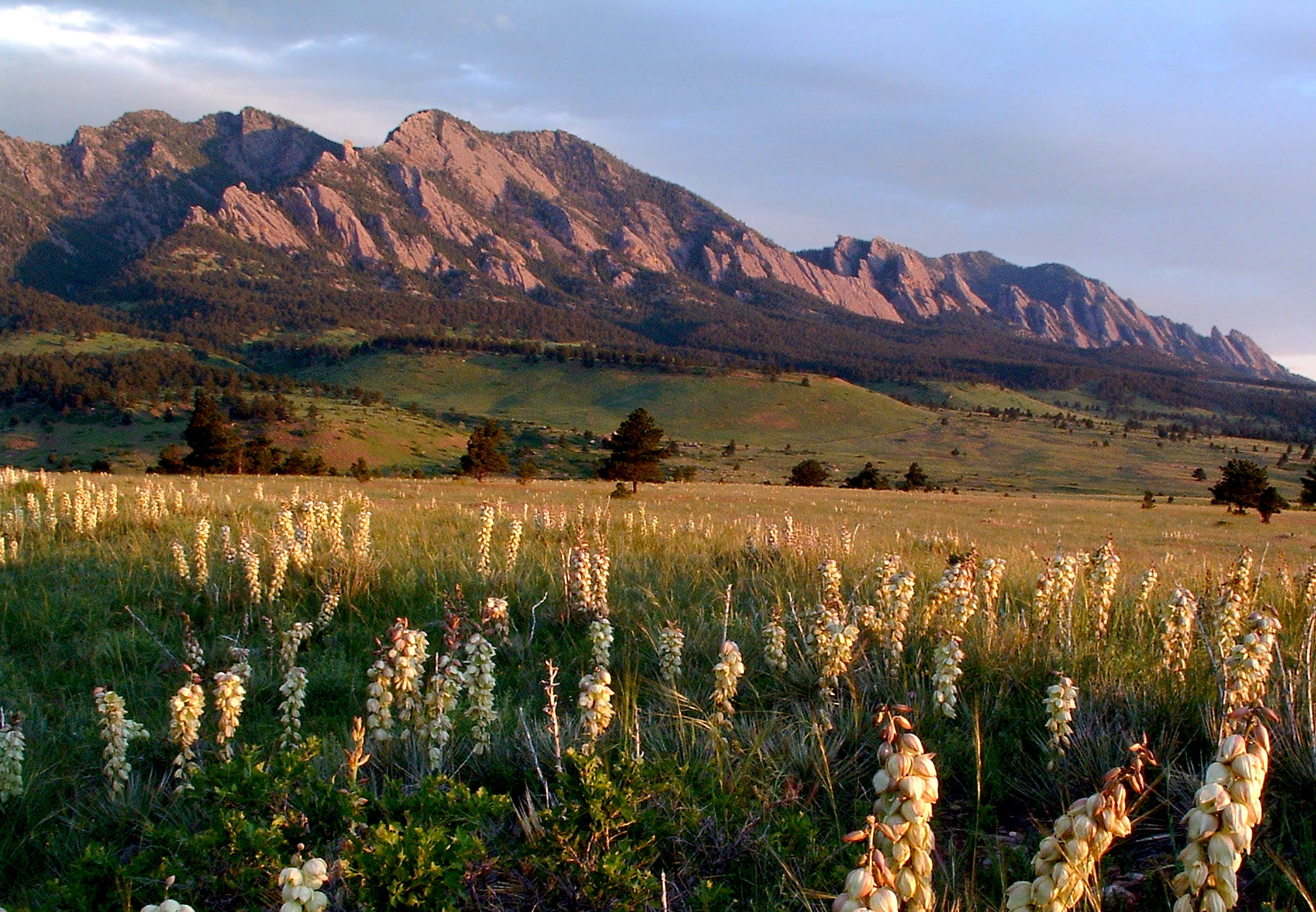
3. Flagstaff Trail
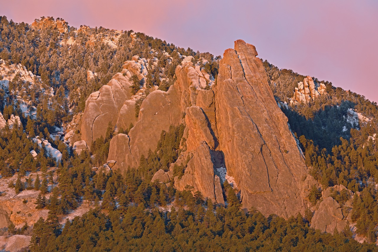
Distance: 1.5 miles
Difficulty: Easy
Location: Boulder
The Lowdown: While a bit muddy, Flagstaff Trail is a great alternative to some of the more popular hikes around the flatirons and ends at a beautiful lookout point. You can also continue on other connected trails if you want to keep going.
4. Carpenter Peak Trail
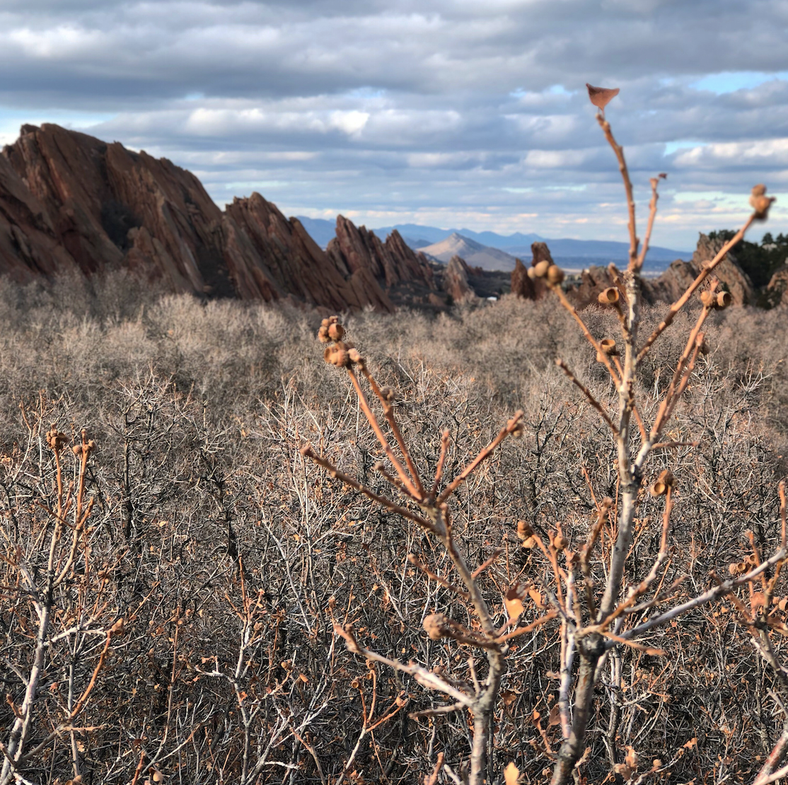
Distance: 6 miles
Difficulty: Moderate
Location: Roxborough State Park
The Lowdown: If you haven’t been to Roxborough State Park, you’re missing out. Driving towards it, you won’t believe you’re about to come up on a dramatic red rock area, but all of a sudden, the landscape changes and you’re in those towering red sandstone rock formations Coloradans know and love. Carpenter Peak Trail trails you through tree tunnels and eventually gives way to an overlook of the park’s geology.
5. Bear Paw Trail via Mason Creek Trail

Distance: 7.6 miles
Difficulty: Moderate
Location: Staunton State Park
The Lowdown: You may still need traction for this hike as it’s fairly shaded, but the views at the end are worth it. Once you reach Bear Paw Trail, the loop takes you to Pikes Peak Overlook and Catamount Overlook, which offer 180-degree views of surrounding mountains.
6. High Dune Trail
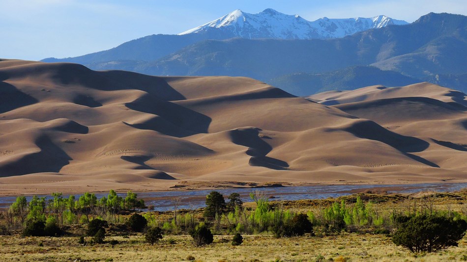
Distance: 2.2 miles
Difficulty: Hard
Location: Great Sand Dunes National Park and Preserve
The Lowdown: If you’re really looking for a change in weather and surroundings, head to the Sand Dunes for a weekend. The High Dune Trail will get you your strenuous hiking fix as it’s a steep, difficult climb despite the shorter length. Be prepared with a map as the trail isn’t marked and you’ll need to follow the ridges of the sand. Plan to hike this trail at the end of the day for a great sunset view.
7. Kenosha Pass North
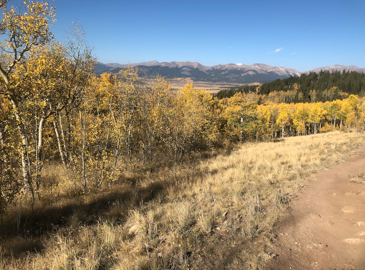
Distance: 7 miles
Difficulty: Moderate
Location: Pike National Forest
The Lowdown: Popular in the fall for its changing aspens, Kenosha Pass is also a great hiking spot in the spring—plus, it’s less crowded. Weave your way through groves of aspens that are just starting to bloom before coming up upon open-expanse views.
8. Ute Canyon Trail
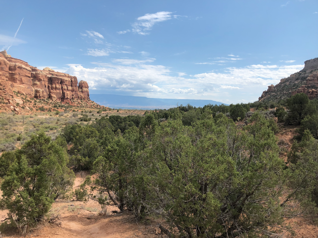
Distance: 11 miles
Difficulty: Moderate
Location: Colorado National Monument
The Lowdown: If you really want to warm up, head to the Colorado National Monument in Grand Junction to soak up some sun on long, ice-free hikes. The Ute Canyon Trail is worth the lengthy mileage, as you get to travel through the mouth of the canyon, viewing the famous arch formations of the area. The majority of the hike is flat, the only real climb is at the end when you have to climb back up and out of the canyon.
9. Warner Point Nature Trail
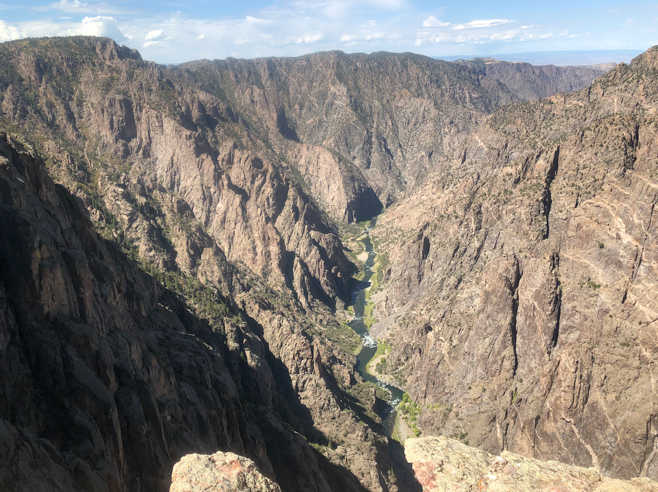
Distance: 1.5 miles
Difficulty: Easy
Location: Black Canyon of the Gunnison National Park
The Lowdown: Canyons are always warm right? Well Black Canyon sure is. Explore the park on several shorter trails, but make sure you hit Warner Point Nature Trail, which has arguably the best view in the park.
10. Hunt Lake Trail

Distance: 4.3 miles
Difficulty: Moderate
Location: San Isabel National Forest
The Lowdown: While Salida sits near the famously snowy Monarch Pass, the town itself doesn’t see nearly as much snow or cold weather as the towns beyond the pass, making surrounding hikes feasible in the spring. Hunt Lake Trail may be a bit muddy and you might still want to use traction, but you’ll get the taste of mountain hiking that you’re craving. The trail passes Boss Lake Reservoir before making its way to Hunt Lake.
Maybe these trails were clear last week. Many places got significant snow yesterday, with Kenosha and Hunts Lake certainly getting significant snow. Two hikers are currently lost off of Kenosha Pass. Please don’t misled people into taking serious risks.
Hi Brant, that’s terrible news about the lost hikers and I hope they get home safely soon! This article was intended to share hikes that were generally at lower elevations or in warmer parts of Colorado that we wouldn’t expect as much snow as in other parts of the mountains. As we know, Colorado weather can be unpredictable as with last week’s snow, and taking current weather forecasts into account is always advised when setting out for a hike. I do have a disclaimer in the article about weather before hikes are listed.
Great articles! I’d love to learn more about cat friendly hikes in Colorado.
Hi Lindsay, glad you enjoyed the read! That’s a fun idea and I’ll look into it!