

Close to Denver
Horseshoe Trail in Golden Gate Canyon State Park
Distance: 3.8 miles (roundtrip)
Difficulty: Moderate
Trail map: Go here
The Lowdown: Following small streams, crossing bridges and winding through aspen groves, this state park trail certainly won’t disappoint during the fall season. A nice bonus is the wildlife viewing, so keep an eye out for birds and deer in the area. There’s a visitor center to pay daily entry and get a map, park at the Frazer Meadows parking lot for the Horseshoe Trailhead.
Mason Creek and Old Mill Loop in Staunton State Park

Distance: 7.3 miles (roundtrip)
Difficulty: Moderate
Trail map: Go here
The Lowdown: Located in Staunton State Park, this hike is less than an hour from Denver. Featuring a wide range of trail type and things to see, it’s hard to get bored on this beautiful loop. Starting off in an open meadow with wide flat gravel paths, expect mountain bikers and dog walkers to join you on your hike, but as you get deeper into the park you’ll be greeted by the trickling sound of Mason Creek and the flittering of aspen filled forests. Towards the second half of your trip, you’ll find historical sites including an old mill and a bunker house as well as a beautiful red rock formation that’s straight from a rock climber’s dream. And as a bonus, it’s dog-friendly, too. – Brittany Werges
Elk Meadow Park Loop in Evergreen

Distance: 5.1 miles (roundtrip)
Difficulty: Easy
Trail map: Go here
The Lowdown: Hiking this loop will pull you through various pine, bright yellow aspen forests and meadows, which offers a change of scenery the entire hike. Use the south parking lot of Elk Meadow Park and begin at the Stagecoach trailhead. Go on this loop clockwise by getting on Meadow View Trail>Founders Trail>Painters Pause Trail and finish the loop on Sleepy S Trail. This is what creates a large loop around Elk Meadow Park.
West of Denver
Tom Blake trail in Snowmass Village
Distance: 8 miles (roundtrip)
Difficulty: Moderate
Trail map: Go here
The Lowdown: The Tom Blake trail is an out and back trail. Located in a place you would never really think of during this time of year, right on the outskirts of Snowmass Village Ski Resort. This hiking trail will take you through 360-degree views of gold, red and orange. Whether it’s the fallen aspen leaves on the trail beneath your feet or light breeze gusts moving foliage, you’ll be surrounded with more aspens than you can handle. Occasionally the trail changes, from being on a narrow trail between tall Aspen trees to wide-open meadows where you can see all of the color transformations at a distance. From CO-82 onto Owl Creek Road toward Snowmass Village, there’s a small parking lot to the trailhead located between Mandalay Lane and Pine Crest Drive. If you passed Pine Crest Drive, you’ve gone too far.
East Lake Creek in Edwards

Distance: 4 .1 miles (roundtrip)
Difficulty: Moderate
Trail map: Go here
The Lowdown: This trail starts uphill and goes through an aspen forest. In fact, you’ll be hiking through an aspen forest and lodgepole pines for most of time. Eventually, you’ll find yourself going downhill for the rest of the way to the wooden bridge across the creek, so be sure to bring a hiking stick. You’ll be pleased with a gold carpet of aspen leaves on the trail. The hike becomes more open when you reach Holy Cross Wilderness and stays that way most of the way to the creek. To get there from Vail, take I-70 west to the Edwards exit#163. As you come off the exit, turn left and go through Edwards to the intersection with U.S. Hwy. 6. Turn right onto U.S. Hwy. 6, then go 0.7 miles to Lake Creek Road. Turn left onto Lake Creek Road, and go 1.8 miles to West Lake Creek Road. Turn right onto West Lake Creek Road, pass Pilgrim Downs, and keep going, (about 4 miles from your turn off), to the trailhead which is just before the road closure gate. You’ll see the trailhead on your left and a small parking area. This fall hike goes to the wooden bridge at East Lake Creek.
Butler Gulch Trail in Clear Creek County

Distance: 5 miles (roundtrip)
Difficulty: Moderate
Trail map: Go here
The Lowdown: Clear Creek County is just barely an hour outside of Denver, providing a long stretch of views, waterfalls, and aspens peeking out among the green landscape. This trail is year-round, whether it be snowshoeing or hiking, you’ll find plenty of pictures from all seasons of this trail online. Find parking at the trailhead or the by the Henderson Mine facility and then head south on Butler Gulch Trail from there.
North of Denver
Lower Dadd Gulch Trail in Arapahoe & Roosevelt National Forest

Distance: 7 miles
Difficulty: Moderate
Trail map: Go here
The Lowdown: Plentiful trees with changing leaves, the Gulch is divided into upper and lower segments. The upper half being road an old burn area known as the Dadd Gulch Road, the lower half being an easygoing hiking trail along the creek through pines, aspens, and rock outcrops. The lower section is 3 miles out and three back. This trail is located near Bellvue, Colorado on Hwy 14 west, about 28 miles from Ted’s Place and 2 miles east of Rustic.
South of Denver
Rainbow Gulch Trail in Woodland Park

Distance: 3 .4 miles
Difficulty: Easy
Trail map: Go here
The Lowdown: The Rainbow Gulch Trail offers a flattened gravel trail that leads you through wooded forests in addition to the lake of Rampart Reservoir. Abundant with Aspen and Evergreens once you reach the reservoir, continue on the trail around it for a colorful hike. To get there, go west on Highway 24 from Colorado Springs, for 17 miles to Woodland Park. Turn right onto Baldwin Street for about 3 miles to Loy Creek Road. Turn right and continue 1.5 miles to the intersection with Rampart Range Road. Turn right onto Rampart Range Road. You can find the parking lot approx 2.3 miles to your left.
Cheesman Ranch Loop in Mueller State Park
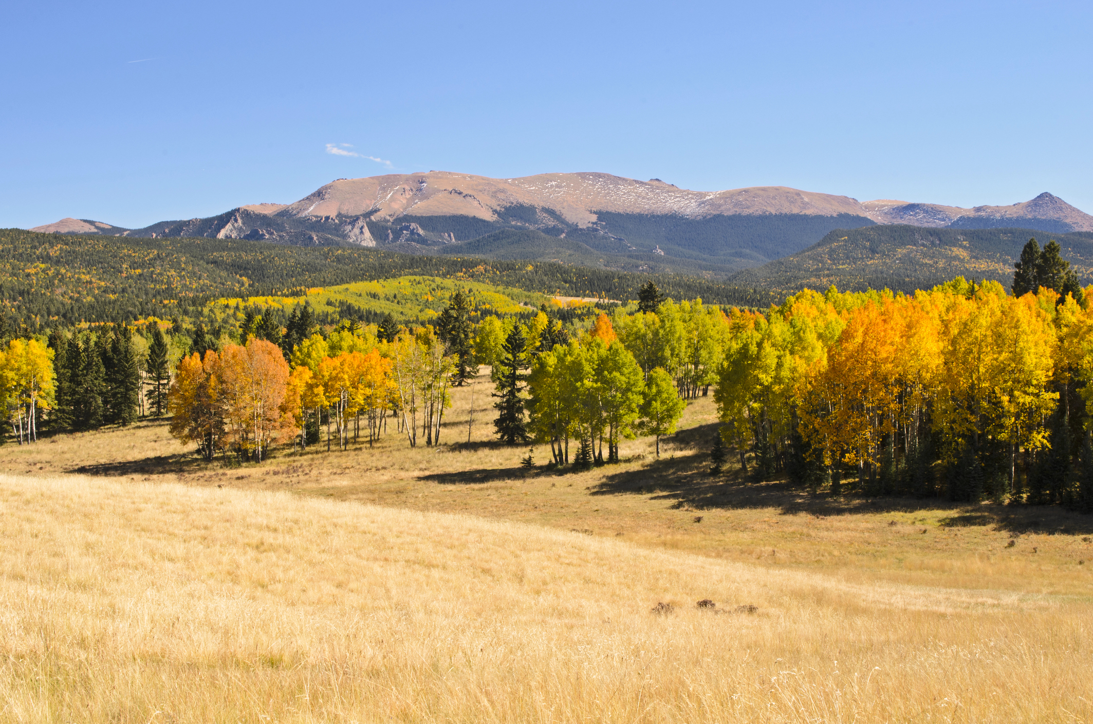
Distance: 5 .7 miles
Difficulty: Moderate
Trail Map: Go here
The Lowdown: This nice wide trail is a loop for hikers, bikers and horseback riders. It will weave in and out of aspen groves and meadows on the north side of the park. Mueller State Park also features cabins and campsites and there are evening walks in the fall to hear elk bugling. Similar to Woodland Park, get there from Colorado Springs by going west on U.S. Highway 24 west towards Divide. Turn left on Colorado Highway 67 and go south 3.5 miles.
Pancake Rocks in between Divide and Cripple Creek

Distance: 6.2 miles roundtrip
Difficulty: Moderate
Trail map: Go here
The Lowdown: Pancake Rocks is an out and back trail located near Cripple Creek, Colorado that’s well forested and moderate. It’s named pancake rocks, due to the unique shaped rocks that are thin and flat like a stack of pancakes. There will also be yellow and red scattered among the green for as far as you can see. The trail is primarily used for hiking, and nature viewing up through October. To get there, drive west from Colorado Springs on US Hwy 24, through Woodland Park, to Divide. Turn south on CO-67. In 9 miles, you’ll see the remains of an old tunnel facing you as you come around a curve. On the other side of this tunnel is the trailhead on the left. But be aware there is no sign, you can park on either side.