If you’re not from Colorado, or are a native that prefers flat terrain, cruising absentmindedly above the speed limit with your tires sliding on icy switchbacks probably isn’t second hat. Sure, the car commercials make it look like cake, but the lack of guardrails at an altitude above 10,000 feet in the winter is enough to make anyone put their hazards on. Colorado is home to some pretty gnarly road conditions on the regular, but these dangerous mountain roads and passes are something else. Winter’s on its way, so buckle up and make sure you check Google Maps twice before making the trip.
Rabbit Ears Pass
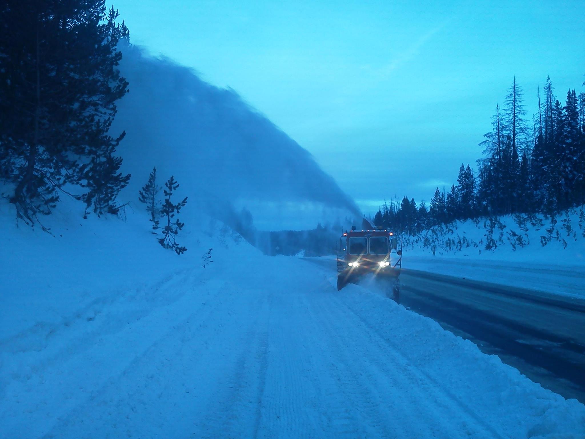
Rabbit Ears Pass via Facebook
Elevation: 9,426 feet
Location: Connects Kremmling and Steamboat Springs, CO via US Highway 40
Why it’s dangerous: If you want to make the trip from Denver to Steamboat Springs for some sweet skiing and hot spring fun, you better watch out—Rabbit Ears Pass sounds like a green circle run, but it is actually an icy slip-and-slide down a mountain. The mountain views are stunning, but the little town of Steamboat far below in a winter storm is enough to make anyone want to throw up. Named for the two columns of basalt rock that resemble little bunny ears, Rabbit Ears Pass is definitely a trap. Make sure you check road conditions before making your way.
Pikes Peak Highway
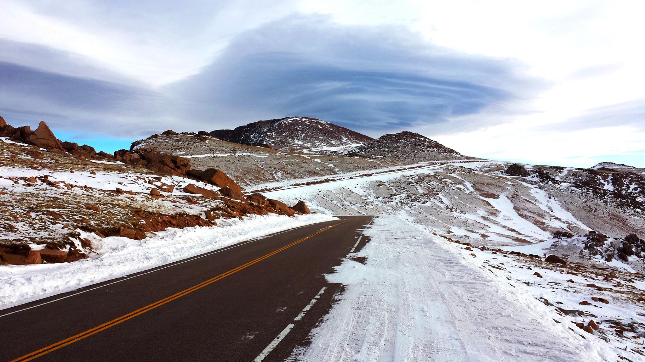
Pikes Peak Highway via Facebook
Elevation: 14,115 feet
Location: Cascade, CO to the summit of Pikes Peak in El Paso County
Why it’s dangerous: Everybody wants to drive up Pikes Peak, and you should make sure you go to see one of the most beautiful mountains in Colorado, but if winding roads make you nauseous, you’re going to want to slow down for this one. With switchbacks galore and steep drops, the Pikes Peak Highway is not for the faint-hearted. The fourteener is definitely worth it, but if you’re concerned, there is a train called the Pikes Peak Cog Railway that makes the journey more bearable.
Imogene Pass
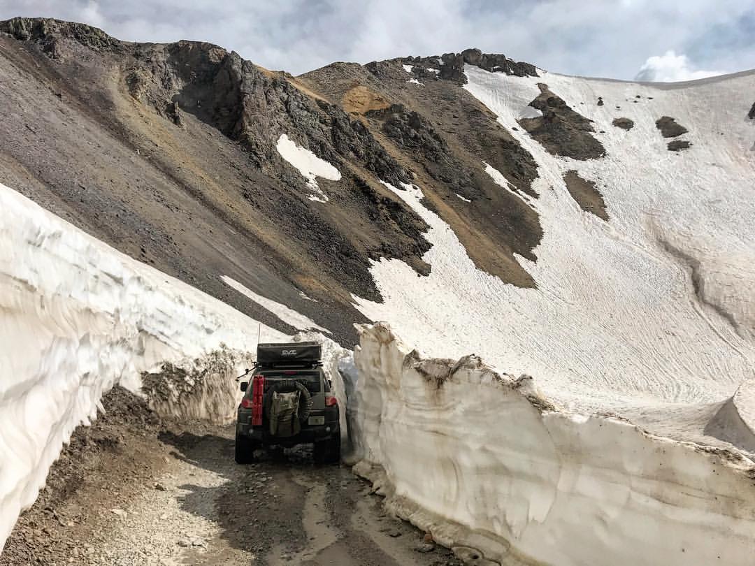
Imogene Pass. Photo by Josh Lau.
Elevation: 13,114 feet
Location: Connects Ouray and Telluride, CO
Why it’s dangerous: If high elevation, freezing temperatures, and huge amounts of snow don’t make you nervous, driving the Imogene Pass between Ouray and Telluride isn’t that bad. But be warned—as one of the highest mountain passes in Colorado, this gravel road is not for beginners. The speed limit is only 15 mph and only 4WD or AWD vehicles can travel on it. Oh—and there’s no guardrails.
Mount Evans Scenic Byway

Mount Evans Scenic Byway via Facebook
Elevation: 14,160 feet
Location: Idaho Springs Visitor Center off I-70 to the summit of Mount Evans
Why it’s dangerous: Considered the highest paved road in North America, the Mount Evans Scenic Byway is unsurprisingly on our list as one that you should prepare for. The trip up the fourteener journeys past the tree line and has limited guardrails. With heart-pumping views straight down the mountainside, the Mount Evans Scenic Byway parallels the Pikes Peak Highway in the fact that you’d be nuts to try and drive it in bad weather.
Argentine Pass
Elevation: 13,207 feet
Location: Connects Clear Creek and Summit Counties
Why it’s dangerous: Feel the fear in your heart as you climb Argentine Pass to 13,000 feet and watch as the road gets narrower and narrower. Unsuitable for oversized vehicles, this treacherous mountain pass is not for timid people. Since it’s in such a remote area, emergency help might take a while, so drivers should be extremely cautious. If it snows too much, this pass isn’t even drivable. Maybe rethink this one.
Loveland Pass
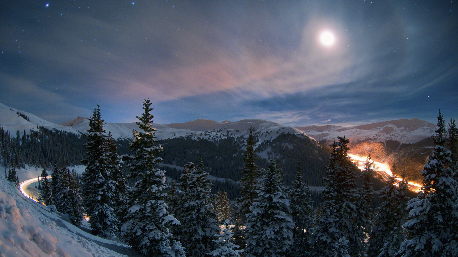
Photo courtesy of Ky0n Cheng via Flickr Creative Commons.
Elevation: 11,991 feet
Location: On CO-6, located between exit 216 of I-70 and Keystone, CO
Why it’s dangerous: With a steep 6.7 percent grade and sharp hairpin turns that make it hard to plow, it’s no wonder the Loveland Pass is closed all the time. Frequent avalanches make the route to Arapahoe Basin’s Ski & Snowboard Area a dangerous feat. If you get caught in a whiteout on this pass, it’ll definitely be terrifying.
Gold Belt Scenic Byway
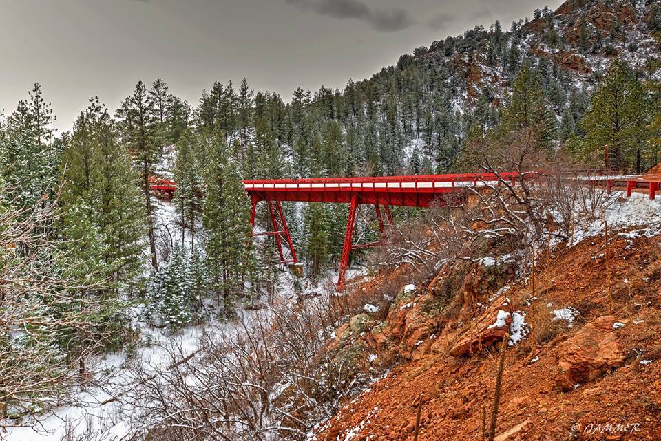
Phantom Canyon Road. Photo by James Martinez.
Elevation: 9,500 feet
Location: Connects Cripple Creek, CO and Victor Mining District to Florence, Cañon City and Florissant, CO. Accessible from US Highway 24 and US Highway 50.
Why it’s dangerous: As one of the lesser-known national scenic byways, the Gold Belt Tour connects roads through a variety of scenery ranging from canyons to mountains. Connecting a historic mining town and numerous cities in Colorado, the Gold Belt makes a beautiful weekend trip. But watch out. Two segments on this scenic journey are particularly unforgiving. Phantom Canyon Road features one-way tunnels, narrow gaps and a red curved bridge to master, while Shelf Road is carved along the side of a cliff that is supposed to fit two lanes, but really only fits one. Don’t say we didn’t warn you.
Coal Bank Pass

Coal Bank Pass via Facebook
Elevation: 10,640 feet
Location: Traversed by the Million Dollar Highway (US Highway 550) from Silverton to Durango, CO.
Why it’s dangerous: The Million Dollar Highway, which is consistently named one of the most dangerous roads in the world, is nicknamed that because you’d have to probably be paid a million bucks to drive it. Legitimately called the San Juan Skyway, this nasty trek in southwestern Colorado features the Coal Bank Pass, a very steep and very scary road with weather that is harsh and unpredictable. But don’t worry, there are truck ramps in case that semi behind you takes a turn for the worse.
Red Mountain Pass
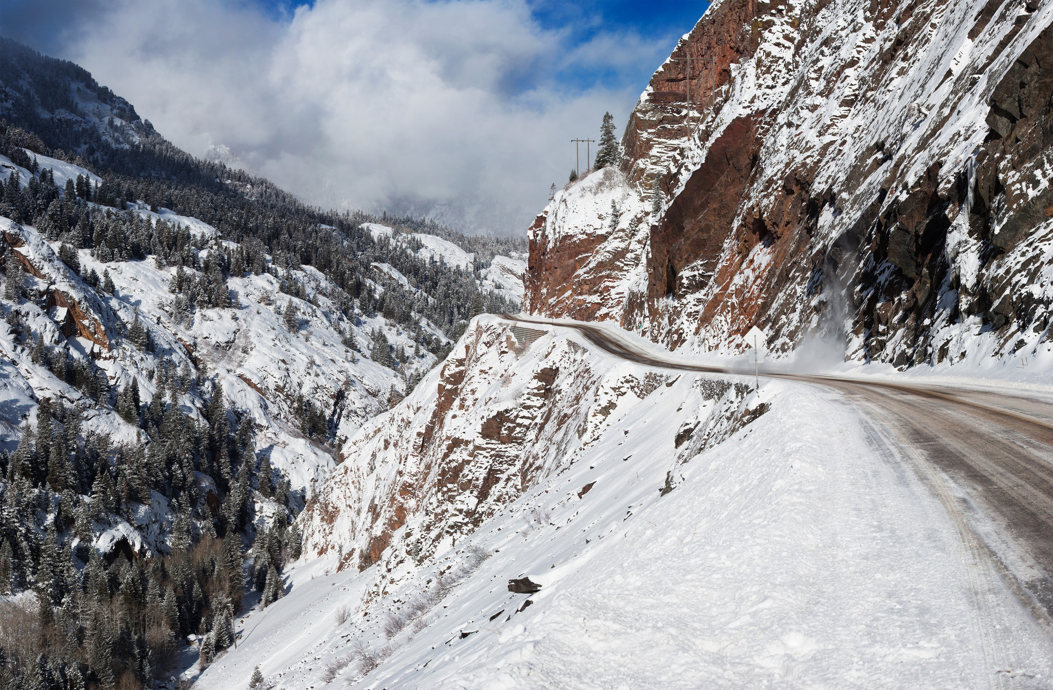
Million Dollar Highway. Photo by Alan Stark via Flickr Creative Commons
Elevation: 11,018 feet
Location: Traversed by the Million Dollar Highway (US Highway 550) from Silverton to Ouray, CO.
Why it’s dangerous: Another, perhaps worse, segment of the Million Dollar Highway is Red Mountain Pass. A challenging drive in any season, this road is probably best traveled at five mph if you want to live. Too narrow for guardrails, the Red Mountain Pass will make you cry as you look down the sheer cliff drop beside you. Maybe skip this one.
Oh My God Road
Elevation: 9,383 feet
Location: Connects Idaho Springs, CO at I-70 to Central City, CO near US Highway 119
Why it’s dangerous: Yeah, this one earns its name all right. Although it’s only 8.5 miles, the Oh My God Road is a two-way road that only has room for a car and a half. With no guardrails and cliffs, this road from Idaho Springs to Central City is a shortcut that comes at a deadly cost if you’re reckless.
Wolf Creek Pass
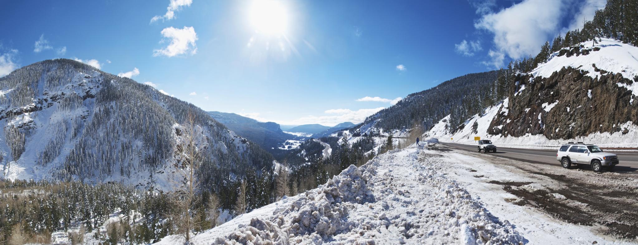
Wolf Creek Pass via Wikipedia Commons
Elevation: 10,856 feet
Location: Traversed by US Highway 160 between South Fork and Pagosa Springs, CO
Why it’s dangerous: Well, there you have it. If you thought the other mountain passes and roads looked bad, the Wolf Creek Pass is actually the worst according to experts who rated it based on “snow, switchbacks, steepness, traffic, elevation, distance from help and frequency of accidents” in the Durango Herald. With seven percent grades, switchbacks and zero visibility on most days, the Wolf Creek Pass is a warning for truckers who are told to “beware the wolf.” The writer of this post has unfortunately traveled this one, so you’re getting a first-hand opinion to stay away.
Tips for Driving Safe This Winter
- Pack in case of emergency. Keep canned food, bottled water, warm clothes, blankets, ice scraper, an emergency flare, spare tire, tool kit, flashlight, first-aid kit and other essentials in your vehicle.
- Use snow tires or drive a 4WD or AWD vehicle. Many passes are dangerous if you have anything else, and you can be fined for not doing so.
- Check road conditions. Visit www.cotrip.org or call 511 for information on road conditions and view camera footage.
- Don’t go down a mountain road faster than you would go up it. It’s easy to zoom down, but this is when most accidents happen. Downshift to S or L, so you don’t wear out your brakes.
- Check your brakes, defroster, heater, windshield wipers and exhaust systems regularly. Take good care of your vehicle in preparation for cold weather. Maintenance is essential.
- Don’t ride the center line. It’s easy to get scared and hug the middle, but be wary of other vehicles that may be coming in the opposite direction.
- The car going uphill has the right of way. So give them their space. Move over as much as you can to let them pass.
- In case of emergency, don’t panic. Our Colorado Department of Transportation is one of the best in the country, and they know what to do. Call 911 for assistance.