The time has almost come to swap out the lightweight summer wardrobe for sweaters, pants and your favorite fall drink. As fall slowly begins to creep in and the weather changes on us, it is a great time to plan for hikes around the fall colors.
The aspens will change quickly and getting up to the mountains the last weeks of September and the first week of October will yield spectacular views. Here is a list of some good spots to visit before the winter cold sets in.
The Map
Booth Falls – Vail
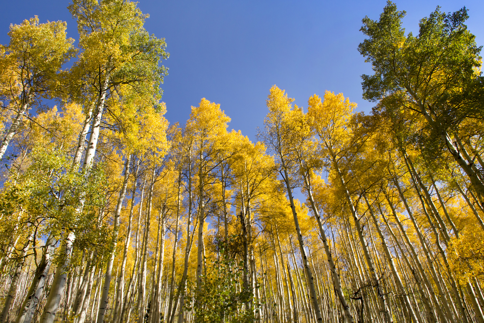
Aspens near Vail, Colorado. Photo via Thinkstock
Distance: 3.9 miles
Difficulty: easy-moderate
What you’ll see: Just off of the East Vail exit on I-70, Booth Falls Trail offers hikers a moderately difficult trek up to a good-sized waterfall through a mixture of vegetation. The first portion of the hike takes you through open fields dotted with aspen trees making for some good color viewing on the way up. In addition to the hike itself, you’ll be able to turn around and great views of East Vail and Vail Mountain.
Upper Piney River Falls – Vail
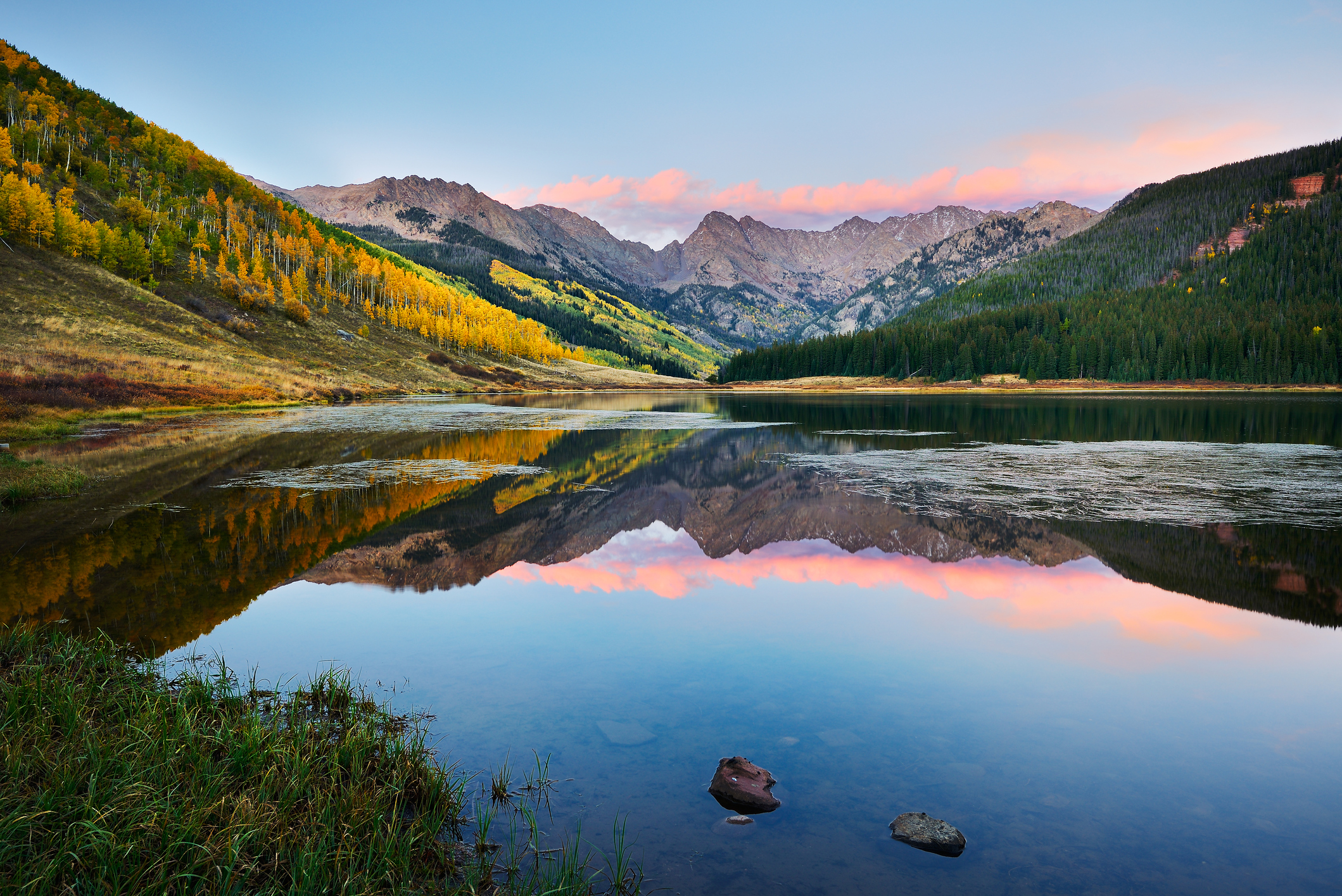
Piney Lake at Sunset near Vail Colorado via Thinkstock
Distance: 6 miles
Difficulty: easy-moderate
What you’ll see: Piney Lake and the Piney River hikes offer a good variety of fall viewing options. You are able to drive right up Piney River Ranch and enjoy the beautiful views around the lake. The adjacent Piney River Falls hike takes you up six-miles through a mix of meadows and aspen groves. The hike is well worth it — leaving you with breath-taking views along the river back to piney lake.
Aspen Alley – Breckenridge
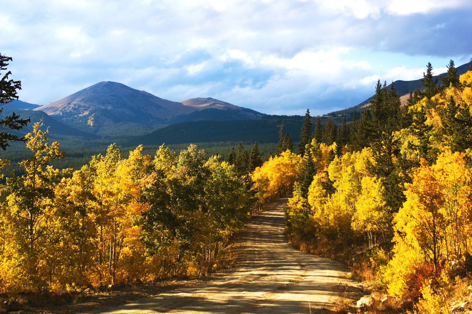
Boreas Pass, Colorado via Thinkstock
Distance: 1.3 miles
Difficulty: moderate
What you’ll see: Aspen Alley is primary known for mountain biking and this makes for a fun and unique way to check out the fall colors. Located off of Boreas Pass Road in Breckenridge the trail name is a perfect description of what you will find, a single track enclosed by aspen trees on all sides. Keep an eye for hikes and mountain-bikers as this a mixed-use trail.
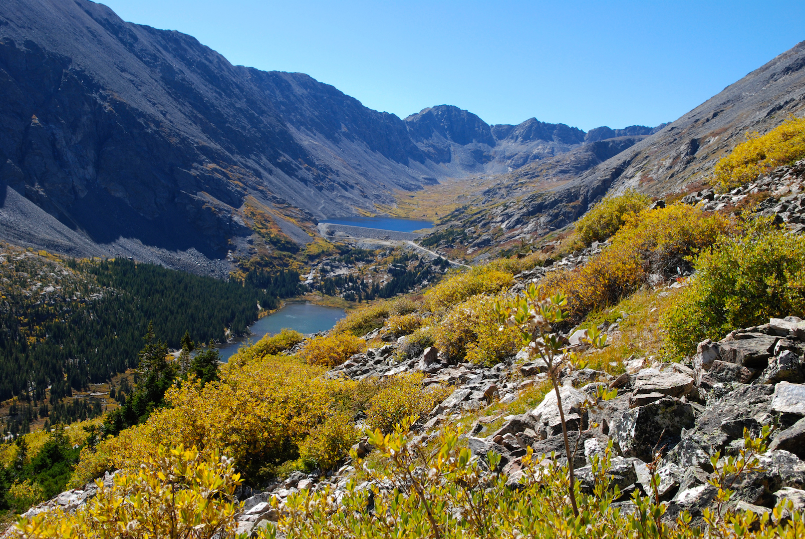
Silver Dollar Lake and Murray Lake — Guanella Pass
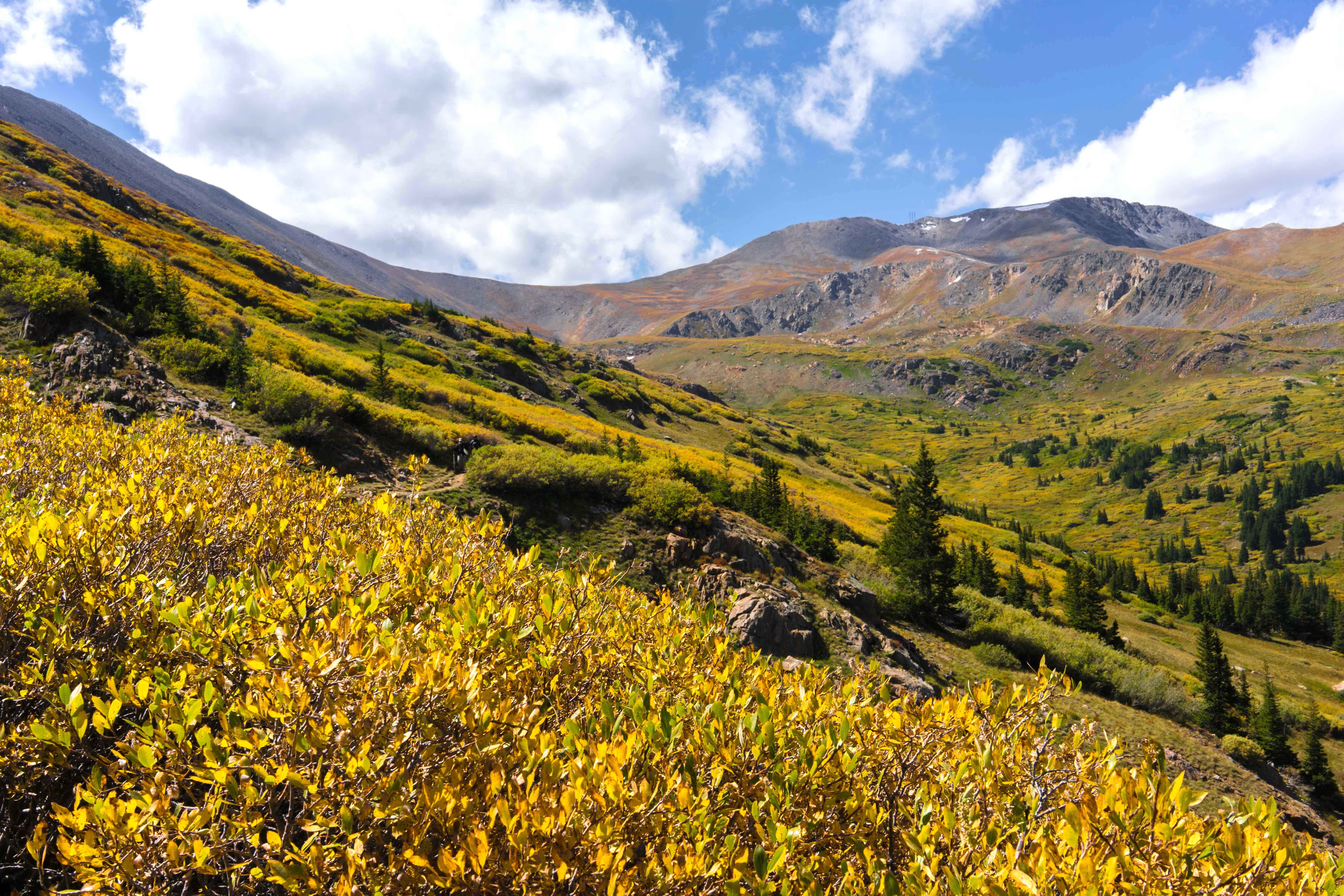
Silver Dollar Lake Trail. Photo and Silver Dollar Lake description by Brittany Werges
Distance: 3.9 miles
Difficulty: easy-moderate
What you’ll see: If you want to take in some fall colors while sticking closer to Denver, Guanella Pass is a must. The drive up the switchbacks and into the valley alone will satiate your fix for fall colors. But if you want to go further, take Naylor Lake Road right after the Guenalla Pass campgrounds to the Silver Dollar Lake trailhead. This hike is relatively moderate for how high above tree line it’ll take you (12,500 feet). With rolling hills and not one, but three lakes, the gorgeous trail is blanketed with fields of colored brush. It’s different than your typical fall hike since it won’t lead you to a forest of aspens but the high altitude hike will give you panoramic views of the golden valley that are just as good.
Mohawk Lakes – Breckenridge
Lakes near Breckenridge, Colorado. Photo via Thinkstock.
Distance: 8.9 miles
Difficulty: moderate-hard
What you’ll see: Located at US 9 and Spruce Creek Road, Mohawk Lakes is a moderate hike nine-mile hike. While the actual lake at the top is a little barren above treeline, the hike up takes you through a nice wooded mix of trees and past several smaller lakes opening up to some great views. Bring a warm layer with you, the top will be windy.
Crater Lake – Aspen
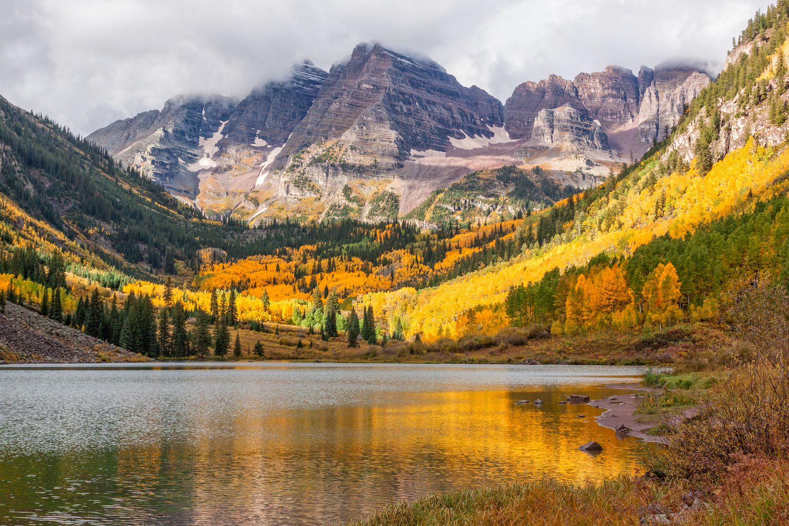
Maroon Bells and Maroon Lake on the way to Crater Lake.
Distance: 3.9 miles
Difficulty: easy-moderate
What you’ll see: A short trek past Maroon Lake near Maroon Bells, the often-over-looked Crater Lake provides hikers with some amazing views and fantastic fall colors. The moderately rated trail takes hikers through winding aspen groves up to Crater Lake. If you arrive after 8 a.m. you will need to ride the bus from the Aspen Highlands parking lot up to the Maroon Lake Trailhead. The bus costs $8 per person and if you drive your own vehicle it will be $10 per vehicle.
Hunter Creek Trail – Aspen
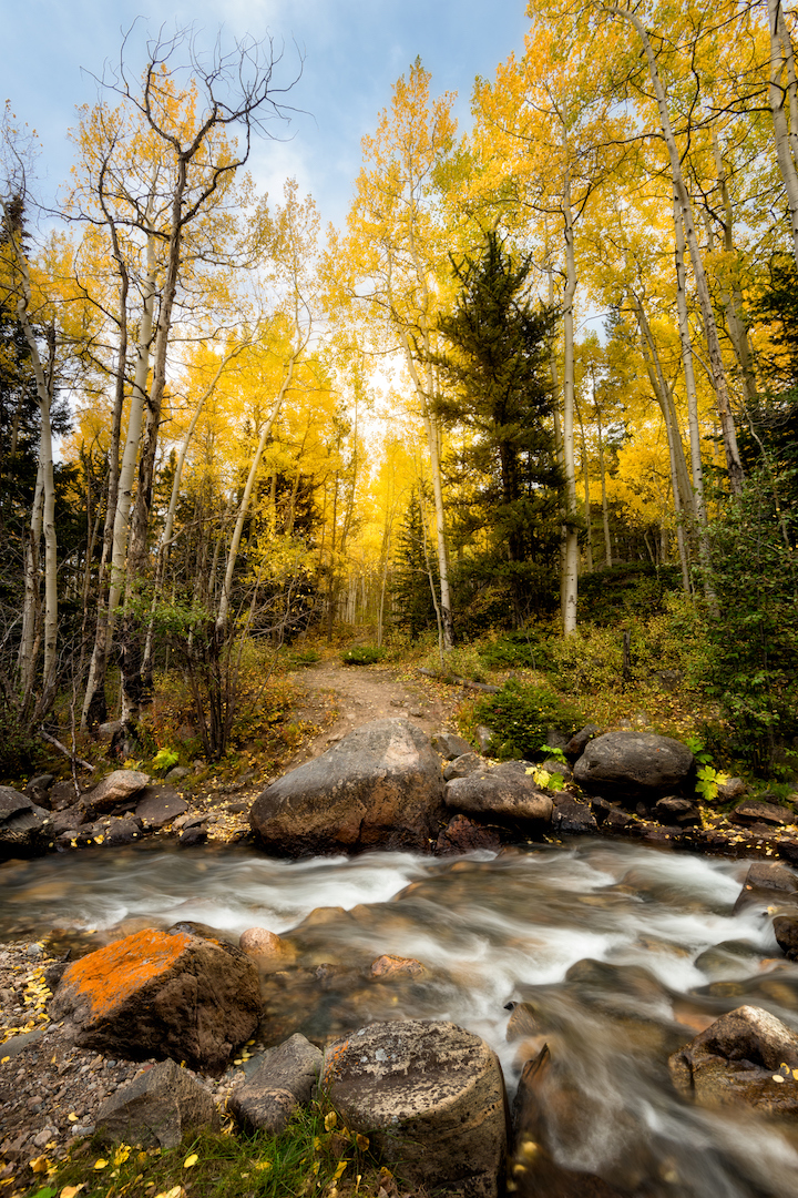
Photo via Thinkstock.
Distance: 2.5 miles or 7 miles
Difficulty: moderate
What you’ll see: Hunter Creek Trail is the perfect gateway-trail to link several fall color options together. Located on Hunter Creek Road just outside of downtown Aspen, hikers will be immersed in aspen trees hiking alongside running water. The trail can be as short as 2.5-miles if you stop at Van Horn Park or as long as seven-miles if you choose to include Midway Creek Trail.
Capitol Creek Trail – Snowmass
View of Capitol Peak, in Snowmass Wilderness, Colorado. Photo via Thinkstock.
Distance: 12.8 miles
Difficulty: moderate-hard
What you’ll see: Located off of Snowmass Creek Road, Capitol Lake Trails is the longest trail on the list coming in at just under 13-miles round trip. The hike is well worth the distance, taking you through a valley filled with aspen trees to the scenic Capitol Lake with a nice view of Capitol Peak. Be aware, you may encounter grazing cows throughout the trail.